
IMAGES TAKEN NEAR TO
Heath Road, BEDWORTH, CV12 0AR
Introduction
This page details the photographs taken nearby to Heath Road, CV12 0AR by members of the Geograph project.
The Geograph project started in 2005 with the aim of publishing, organising and preserving representative images for every square kilometre of Great Britain, Ireland and the Isle of Man.

There are currently over 7.5m images from over14,400 individuals and you can help contribute to the project by visiting https://www.geograph.org.uk
Image Map
Images are licensed for reuse under creativecommons.org/licenses/by-sa/2.0
Notes
- Clicking on the map will re-center to the selected point.
- The higher the marker number, the further away the image location is from the centre of the postcode.
Image Listing (13 Images Found)
Images are licensed for reuse under creativecommons.org/licenses/by-sa/2.0
Image
Details
Distance
1
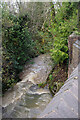
Stream at Bedworth Heath
Effectively a branch of the River Sowe, this stream is seen from the Heath Road bridge. Heavy recent rain has resulted in a strong flow.
Image: © Stephen McKay
Taken: 18 Nov 2022
0.09 miles
2
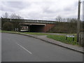
High Level A444
The A444 dual carriageway cuts through Bedworth on a high embankment.
Image: © Michael Patterson
Taken: 21 Mar 2006
0.13 miles
4
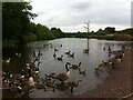
Pond at the Nook, Bedworth
The Nook is one of the many small nature and wildlife parks dotted around Nuneaton & Bedworth, often on former industrial sites. The pond at the Nook has formed next to one of the headwaters of the River Sowe. It doesn't appear on the OS Six Inch map, 1888-1913 series, and is perhaps a flash resulting from subsidence caused by the nearby Newdigate Colliery, which closed in 1982. The pond is clearly popular with a flock of Canada geese, who have decided to leave the water en masse to go pecking in the undergrowth nearby.
Image: © A J Paxton
Taken: 19 Jun 2021
0.21 miles
5
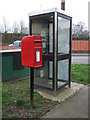
Elizabeth II postbox and telephone box on Woodlands Road
Postbox No. CV12 563.
See Image] for close up.
Image: © JThomas
Taken: 11 Mar 2017
0.21 miles
6
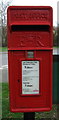
Close up, Elizabeth II postbox on Woodlands Road
Image: © JThomas
Taken: 11 Mar 2017
0.21 miles
7
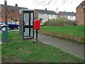
Elizabeth II postbox and telephone box on Woodlands Road
Postbox No. CV12 563.
See Image] for close up.
Image: © JThomas
Taken: 11 Mar 2017
0.21 miles
8
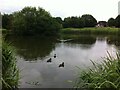
The Sidings Pool, Bluebell Drive Park, Bedworth
This pond is situated near the junction of Heath Road and Smorrall Lane, in the western suburbs of Bedworth. It is known locally as the Sidings Pool, and a glance at the OS Six Inch map, 1888-1913 Series, shows a siding here running off the mineral railway that connected the Newdigate Colliery on Astley Lane to the Coventry-Nuneaton railway line to the east. The colliery closed in 1982 and the tracks have long since been removed, but the route of the mineral railway can still be traced, especially where it passes through cuttings. https://maps.nls.uk/geo/explore/side-by-side/#zoom=16&lat=52.47762&lon=-1.50003&layers=6&right=OSAPI
Image: © A J Paxton
Taken: 19 Jun 2021
0.22 miles
10
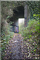
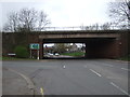
Footpath bridge under the A444
This seems a very substantial bridge to carry the Bedworth by-pass over a footpath. In fact when the road was built in the 1970s there was a railway here - the Newdigate Colliery Railway. The colliery was closed in 1982 and the railway would have done so, probably shortly afterwards, when all remaining coal stocks had been removed.
Image: © Stephen McKay
Taken: 18 Nov 2022
0.22 miles