
IMAGES TAKEN NEAR TO
The Precinct, COVENTRY, CV1 1NR
Introduction
This page details the photographs taken nearby to The Precinct, CV1 1NR by members of the Geograph project.
The Geograph project started in 2005 with the aim of publishing, organising and preserving representative images for every square kilometre of Great Britain, Ireland and the Isle of Man.

There are currently over 7.5m images from over14,400 individuals and you can help contribute to the project by visiting https://www.geograph.org.uk
Image Map
Images are licensed for reuse under creativecommons.org/licenses/by-sa/2.0
Notes
- Clicking on the map will re-center to the selected point.
- The higher the marker number, the further away the image location is from the centre of the postcode.
Image Listing (1202 Images Found)
Images are licensed for reuse under creativecommons.org/licenses/by-sa/2.0
Image
Details
Distance
1
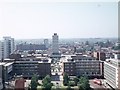
Coventry city centre
Taken from the tower of the old cathedral church of St. Michael, looking westwards down the line of the Upper and Lower Precinct shopping areas towards Mercia House[1], the tower block at the bottom end of the Lower Precinct. To the right of Mercia House is the red sandstone tower of St John's Church. To its left a little further into the distance is the former GEC factory (previously the Rudge works) on the site now occupied by the Skydome and Odeon complex in Spon Street. In the foreground is Broadgate with the statue of Lady Godiva. The green square is now paved and covered by the Cathedral Lanes development. The building on the left of the immediate foreground was Martins Bank, one of the few buildings of pre-war Broadgate to survive and stood on the corner of Pepper Lane.
Comparative views:
1983 : Image]
2007 : Image]
2016 : Image] (Oliver Mills)
Image: © E Gammie
Taken: 11 Jun 1975
0.00 miles
2
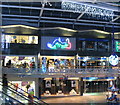
Coventry's Industries - textile
From ribbon weaving, which collapsed in the mid-19th century, to man-made textiles at Courtaulds - which collapsed in the latter half of the 20th century.
Image: © E Gammie
Taken: 24 Nov 2013
0.01 miles
3
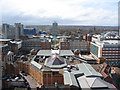
Precincts and Mercia House
Mercia House and the Upper and Lower Precincts were designed to be in alignment with St Michael's spire, from which this photo was taken. Cathedral Lanes in the foreground largely obscures Broadgate, around which offices, shops and a hotel are set.
Beyond Mercia House is the residential tower block of Meadow House in Spon Street.
In the distance the land rises towards Tile Hill in the west of Coventry.
Since 2007 ( http://www.geograph.org.uk/photo/554599 ) Ikea has been completed and the canopy has been removed from the Broadgate side of Cathedral Lanes.
A circuit round the tower:
http://www.geograph.org.uk/photo/2917674 < anti-clockwise | clockwise > http://www.geograph.org.uk/photo/2917720
Image: © E Gammie
Taken: 25 Apr 2012
0.01 miles
4
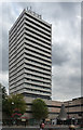
Mercia House, The Precinct, Coventry
One of a number of similarly-styled towers dotted around Coventry. Built in 1967 by Arthur Ling and Terence Gregory. It stands on axis with the city's new shopping precincts to punctuate the view from the old cathedral. Built as offices, it is now flats, and at a little over 230 feet, Coventry's tallest building.
It "overlooks the first traffic-free shopping street in Europe. The whole precinct was constructed out of the rubble of historic Coventry that was bombed in World War 2." (Information from skyscrapernews.com.)
Image: © Stephen Richards
Taken: 22 Aug 2011
0.01 miles
5
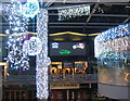
Coventry's Industries - car manufacture
The predominant industry in the city for much of the 20th century.
Image: © E Gammie
Taken: 24 Nov 2013
0.02 miles
6

Lower Precinct 1958-2008
A young band playing in the Lower Precinct as part of events highlighting the 50th anniversary of the Lower Precinct. This area was one of the later parts to be redeveloped after WW2 and has more of a 1960s feel than the rest of the pedestrianised areas (the music had a late 70s/early 80s feel). Originally open air, it was refurbished in recent years, the main changes being the addition of the glass roof; polished flooring; replacement of stairs with escalators; removal of stairs at the ramped end and the addition of an arcade to link with the indoor market. Small public events are regularly held here.
In the upper background, the clock on St John's church tower can just be seen.
Image: © E Gammie
Taken: 17 Oct 2008
0.02 miles
7
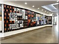
The Cullen Mural, Coventry: main length
The mural makes reference to Coventry's past and present with images of modern buildings, manufactures and historic buildings.
Image ID: 7459890
Image: © Robin Stott
Taken: 20 Jun 2022
0.02 miles
8
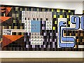
The Cullen Mural, Coventry: main length, middle
Cullen's drawings, on repeated tiles, evoke the mass production of manufactured goods for which the city became famous: bicycles, watches, engines, elements of buildings and – ribbons, plain and rather overstated although in light blue, the colour of Coventry City Football Club.
Image ID: 7460180
Image: © Robin Stott
Taken: 20 Jun 2022
0.02 miles
9
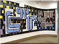
The Cullen Mural, Coventry: main length, right
Dominating this end of the mural is the overlarge ribbon in the light blue associated today with Coventry City Football Club. Shown plain, the ribbons were famously intricately patterned; did Cullen miss a trick or are patterns present in the eye-teasing background tiles across the whole mural? The blue has a history: the city grew wealthy from the sale of finished wool cloth. In the 15th and 16th centuries much of it was dyed with 'Coventry Blue', a lasting fast blue dye made from woad (chemically the same as indigo), madder and sloe berries. The end section of the mural affectionately depicts Georgian buildings.
Image ID: 7460185
Image: © Robin Stott
Taken: 20 Jun 2022
0.02 miles
10
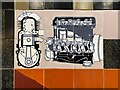
The Cullen Mural, Coventry: engine detail
The image of an engine is in the context of the manufactures that Coventry became famous for: Image
This image ID: 7460211
Image: © Robin Stott
Taken: 15 Apr 2023
0.02 miles