
IMAGES TAKEN NEAR TO
Gipsy Lane, NUNEATON, CV11 4SH
Introduction
This page details the photographs taken nearby to Gipsy Lane, CV11 4SH by members of the Geograph project.
The Geograph project started in 2005 with the aim of publishing, organising and preserving representative images for every square kilometre of Great Britain, Ireland and the Isle of Man.

There are currently over 7.5m images from over14,400 individuals and you can help contribute to the project by visiting https://www.geograph.org.uk
Image Map
Images are licensed for reuse under creativecommons.org/licenses/by-sa/2.0
Notes
- Clicking on the map will re-center to the selected point.
- The higher the marker number, the further away the image location is from the centre of the postcode.
Image Listing (18 Images Found)
Images are licensed for reuse under creativecommons.org/licenses/by-sa/2.0
Image
Details
Distance
1
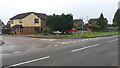
Caroline Close Nuneaton
Caroline Close is a secluded cul-de-sac on the edge of Nuneaton. The photograph shows its junction with Gipsy Lane.
Image: © Peter Mackenzie
Taken: 17 Jan 2017
0.09 miles
2
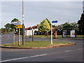
Gipsy Lane bus terminus, Whitestone, Nuneaton
A small green space at the junction of Bulkington Lane, Gipsy Lane, Whitestone Road (off the picture to the left), and Magyar Crescent (off the picture to the right).
Photo taken at approximately 8pm on a surprisingly bright evening.
For many years up to the 1970's a bus route operated by Monty Moreton terminated and turned here. The route ran from Chapel End to Gipsy Lane via Nuneaton town centre. (route information from an article entitled 'Monty's Buses' by Peter Lee on the Nuneaton Society's website)
The white and blue sign (installed c.2005) indicates an off-road cycle route to Nuneaton town centre.
Image: © John Brightley
Taken: 25 May 2010
0.13 miles
3
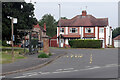
Bulkington Lane, Whitestone
The bus stop is located at the junction of Bulkington lane and Gipsy Lane in the Nuneaton suburb of Whitestone. See also Image taken ten years previously from a different angle.
Image: © Stephen McKay
Taken: 26 Jul 2021
0.13 miles
4
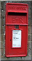
Close up, Elizabeth II postbox on Gipsy Lane, Whitestone
Postbox No. CV11 151.
See Image] for wider view.
Image: © JThomas
Taken: 4 Mar 2017
0.14 miles
5
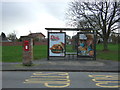
Elizabeth II postbox and bus shelter on Gipsy Lane, Whitestone
Postbox No. CV11 151.
See Image] for close up.
Image: © JThomas
Taken: 4 Mar 2017
0.14 miles
6
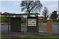
Bulkington Lane, Whitestone
Showing the bus shelter at the junction between Bulkington Lane and Gipsy Lane. See Image for more information about this location.
Image: © Stephen McKay
Taken: 2 Feb 2014
0.14 miles
8
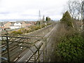
Whitestone, railway lines
West Coast Mainline, in particular the Rugby to Nuneaton line, seen from Gipsy Lane.
Image: © Mike Faherty
Taken: 21 Feb 2016
0.15 miles
9

West Coast Main Line, Whitestone
A Liverpool - Euston Pendolino passes Attleborough South Junction on its way between Nuneaton and Rugby.
Image: © Stephen McKay
Taken: 2 Feb 2014
0.16 miles
10
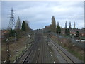
West Coast Main Line
Looking north from the bridge on Gipsy Lane.
Image: © JThomas
Taken: 4 Mar 2017
0.16 miles