
IMAGES TAKEN NEAR TO
Randle Road, NUNEATON, CV10 8HR
Introduction
This page details the photographs taken nearby to Randle Road, CV10 8HR by members of the Geograph project.
The Geograph project started in 2005 with the aim of publishing, organising and preserving representative images for every square kilometre of Great Britain, Ireland and the Isle of Man.

There are currently over 7.5m images from over14,400 individuals and you can help contribute to the project by visiting https://www.geograph.org.uk
Image Map
Images are licensed for reuse under creativecommons.org/licenses/by-sa/2.0
Notes
- Clicking on the map will re-center to the selected point.
- The higher the marker number, the further away the image location is from the centre of the postcode.
Image Listing (13 Images Found)
Images are licensed for reuse under creativecommons.org/licenses/by-sa/2.0
Image
Details
Distance
1
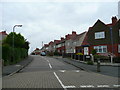
Randle Road, Stockingford
Housing in the western suburbs of Nuneaton.
Image: © Jonathan Billinger
Taken: 4 Sep 2008
0.02 miles
2
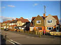
Housing on Meldrum Road, Stockingford
These houses on the upper half of Meldrum Road, seen from the end of Randle Road, appear to have been designed and built as quite a uniform set, but have been altered individually over the years.
Image: © Richard Vince
Taken: 2 Feb 2013
0.05 miles
3
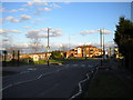
Haunchwood Road, Stockingford
Looking towards Nuneaton town centre from the top of Westbury Road. There is a small park with play area on the opposite side of the road, while some modern low rise flats are visible beyond some recently pruned trees.
Image: © Richard Vince
Taken: 2 Feb 2013
0.13 miles
4
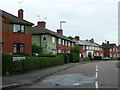
Whitehouse Crescent, Stockingford
Housing in the western suburbs of Nuneaton.
Image: © Jonathan Billinger
Taken: 4 Sep 2008
0.13 miles
5
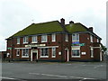
The Cherry Tree
An estate pub off Haunchwood Road between Nuneaton and Stockingford.
Image: © Jonathan Billinger
Taken: 4 Sep 2008
0.16 miles
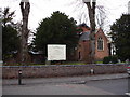
7
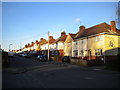
Westbury Road, Stockingford
Looking up Westbury Road towards Haunchwood Road from the end of St Paul's Road.
Image: © Richard Vince
Taken: 2 Feb 2013
0.18 miles
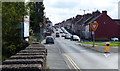
9
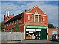
Woodstock Furniture, Haunchwood Road, Stockingford
The 'NCS' terracotta plaques on either side of the first floor facade indicate that the building was originally built for the Nuneaton Cooperative Society. The circular central feature gives a date of 1928. The building seems to be identical to that built in the same year on Heath End Road - see Image
Image: © John Brightley
Taken: 20 Sep 2010
0.20 miles
10
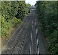
Railway line at Whittleford
Viewed from the Whittleford Road bridge.
Image: © Mat Fascione
Taken: 13 Sep 2015
0.21 miles