
IMAGES TAKEN NEAR TO
Bull Ring, NUNEATON, CV10 7FG
Introduction
This page details the photographs taken nearby to Bull Ring, CV10 7FG by members of the Geograph project.
The Geograph project started in 2005 with the aim of publishing, organising and preserving representative images for every square kilometre of Great Britain, Ireland and the Isle of Man.

There are currently over 7.5m images from over14,400 individuals and you can help contribute to the project by visiting https://www.geograph.org.uk
Image Map
Images are licensed for reuse under creativecommons.org/licenses/by-sa/2.0
Notes
- Clicking on the map will re-center to the selected point.
- The higher the marker number, the further away the image location is from the centre of the postcode.
Image Listing (61 Images Found)
Images are licensed for reuse under creativecommons.org/licenses/by-sa/2.0
Image
Details
Distance
1
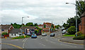
College Street in Nuneaton, Warwickshire
This is the B4112 College Street in Chilvers Coton, Nuneaton, looking south-east from the Bullring. Bullring continues off to the left
Image: © Roger D Kidd
Taken: 19 Aug 2013
0.03 miles
2
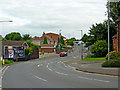
College Street in Nuneaton, Warwickshire
This is the B4112 College Street in Chilvers Coton in Nuneaton, looking south-east from the Bullring.
Image: © Roger D Kidd
Taken: 19 Aug 2013
0.05 miles
3
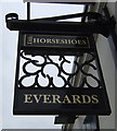
Sign for the Horseshoes public house, Chilvers Coton
Image: © JThomas
Taken: 11 Mar 2017
0.05 miles
4
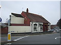
The Horseshoes public house, Chilvers Coton
On Heath End Road.
Image: © JThomas
Taken: 11 Mar 2017
0.05 miles
5
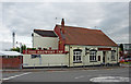
The Horseshoes in Chilvers Coton, Nuneaton
The Horseshoes public house on Bullring in Nuneaton was the Brewery Tap of the Tunnel Brewery in 2013. Not so now (2018); it is an Everards pub.
Image: © Roger D Kidd
Taken: 19 Aug 2013
0.05 miles
6
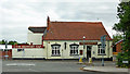
The Horseshoes in Chilvers Coton, Nuneaton
As seen here, the Horseshoes public house on Bullring in Nuneaton used to be the Brewery Tap of the Tunnel Brewery. Not so now (2018); it is an Everards pub.
Image: © Roger D Kidd
Taken: 19 Aug 2013
0.05 miles
7
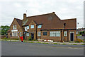
The Boot Inn in Nuneaton, Warwickshire
This image of The Boot Inn dates from 2013, the pub in Chilvers Coton having already closed.
A blog shows the pub converted into apartments by September 2015: http://pubsthenandnow.blogspot.co.uk/2016/09/193-boot-inn-nuneaton-warwickshire-1995.html
Image: © Roger D Kidd
Taken: 19 Aug 2013
0.08 miles
8
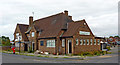
The Boot Inn in Nuneaton, Warwickshire
This image of The Boot Inn on the corner of Amos Avenue and Bullring dates from 2013, the pub having already closed.
A blog shows the pub converted into apartments by September 2015: http://pubsthenandnow.blogspot.co.uk/2016/09/193-boot-inn-nuneaton-warwickshire-1995.html
Image: © Roger D Kidd
Taken: 19 Aug 2013
0.08 miles
9
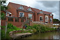
Modern housing overlooking the Coventry Canal by bridge No 20
Image: © David Martin
Taken: 17 Jul 2016
0.09 miles
10
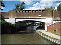
Coventry Canal: Bridge Number 20: Boot Bridge
Boot Bridge carries the Bull Ring / Bridge Street road over the canal in Chilvers Coton. Boot Wharf is beyond the bridge and the Boot Inn is up onto the road and to the left. The photographer does not know which came first.
Image: © Nigel Cox
Taken: 11 Sep 2012
0.10 miles