
IMAGES TAKEN NEAR TO
Croft Road, NUNEATON, CV10 7EJ
Introduction
This page details the photographs taken nearby to Croft Road, CV10 7EJ by members of the Geograph project.
The Geograph project started in 2005 with the aim of publishing, organising and preserving representative images for every square kilometre of Great Britain, Ireland and the Isle of Man.

There are currently over 7.5m images from over14,400 individuals and you can help contribute to the project by visiting https://www.geograph.org.uk
Image Map
Images are licensed for reuse under creativecommons.org/licenses/by-sa/2.0
Notes
- Clicking on the map will re-center to the selected point.
- The higher the marker number, the further away the image location is from the centre of the postcode.
Image Listing (42 Images Found)
Images are licensed for reuse under creativecommons.org/licenses/by-sa/2.0
Image
Details
Distance
1
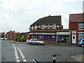
Off-licence, Granby Road, Nuneaton
At the junction with Tomkinson Road.
Image: © Jonathan Billinger
Taken: 4 Sep 2008
0.08 miles
2
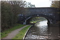
Wash Lane Bridge
Bridge no 21 on Coventry canal.
Image: © Robert Eva
Taken: 25 Oct 2016
0.09 miles
3
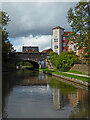
Coventry Canal at Wash Lane Bridge in Nuneaton, Warwickshire
Wash Lane Bridge is No 21 across the Coventry Canal in Nuneaton, and does not carry Wash Lane (any more). The B4102 Croft Lane/Queens Road crosses the canal here.
Wash Lane Farm stood three hundred metres to the north of the bridge, the site now being occupied by the Manor Park Community School and Specialist Arts College. The road to it before recent major land development eliminated it was Wash Lane. The new road is an addition to Queens Road, leading to the town centre.
Image: © Roger Kidd
Taken: 25 Sep 2016
0.10 miles
4
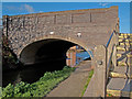
Wash Lane Bridge over the Coventry Canal, Nuneaton
Wash Lane Bridge, carries the B4102 over the Coventry Canal to the east of Nuneaton Town Centre; it's designated number is 21 and an iron plate above the centre of the bridge arch carries that number.
Image: © Trevor Littlewood
Taken: 11 Nov 2007
0.10 miles

6
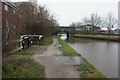
Coventry Canal at Wash Lane Bridge, bridge #21
Image: © Ian S
Taken: 6 Jan 2022
0.10 miles
7
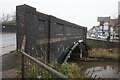
Coventry Canal at Wash Lane Bridge, bridge #21
Image: © Ian S
Taken: 6 Jan 2022
0.10 miles
8

Housing near Wash Lane Bridge
On the Coventry Canal.
Image: © Andrew Abbott
Taken: 2 May 2023
0.10 miles
9
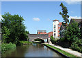
The Coventry Canal at Nuneaton, Warwickshire
This is looking towards Wash Lane Bridge (No 21) though Wash Lane seems to have disappeared beneath twentieth century development.
Image: © Roger D Kidd
Taken: 16 Jun 2010
0.10 miles
10
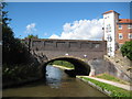
Coventry Canal: Bridge Number 21: Wash Lane Bridge
Wash Lane was up until about 1870 the name of the main thoroughfare from this canal bridge to the centre of Nuneaton. It subsequently became Gas Street reflecting civic pride in the town's gasworks, and then Queen's Road after one of Queen Victoria's Jubilees. Although Queen's Road still exists today nearer the centre of town the straight length of road over the bridge is now the B4102 Croft Road.
Image: © Nigel Cox
Taken: 11 Sep 2012
0.10 miles