IMAGES TAKEN NEAR TO
Rye Walk, HERNE BAY, CT6 7XD
Introduction
This page details the photographs taken nearby to Rye Walk, CT6 7XD by members of the Geograph project.
The Geograph project started in 2005 with the aim of publishing, organising and preserving representative images for every square kilometre of Great Britain, Ireland and the Isle of Man.

There are currently over 7.5m images from over14,400 individuals and you can help contribute to the project by visiting https://www.geograph.org.uk
Image Map
Images are licensed for reuse under creativecommons.org/licenses/by-sa/2.0
Notes
- Clicking on the map will re-center to the selected point.
- The higher the marker number, the further away the image location is from the centre of the postcode.
Image Listing (11 Images Found)
Images are licensed for reuse under creativecommons.org/licenses/by-sa/2.0
Image
Details
Distance
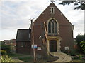
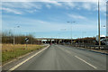
3
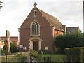
Broomfield Church (2)
On Margate Road.
Image: © David Anstiss
Taken: 8 Aug 2010
0.05 miles
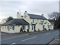
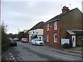
6
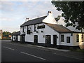
The Plough, Broomfield
On Margate Road, close to the roundabout junction with Hunters Forstal Road.
Note; the Star Sign Pub Sign.
Image: © David Anstiss
Taken: 8 Aug 2010
0.11 miles
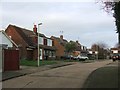
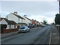
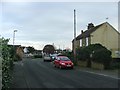
9
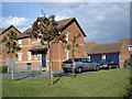
Magnolia Rise, Broomfield
Honeysuckle Way and Magnolia Rise were built by Wilcon homes in 1995 on the site of an old farm. The photograph shows number 3, which is built over an old farmyard pond, not that there any signs of this now!
Image: © Martin Barnard
Taken: 19 Sep 2004
0.24 miles