IMAGES TAKEN NEAR TO
Bogshole Lane, HERNE BAY, CT6 7BX
Introduction
This page details the photographs taken nearby to Bogshole Lane, CT6 7BX by members of the Geograph project.
The Geograph project started in 2005 with the aim of publishing, organising and preserving representative images for every square kilometre of Great Britain, Ireland and the Isle of Man.

There are currently over 7.5m images from over14,400 individuals and you can help contribute to the project by visiting https://www.geograph.org.uk
Image Map
Images are licensed for reuse under creativecommons.org/licenses/by-sa/2.0
Notes
- Clicking on the map will re-center to the selected point.
- The higher the marker number, the further away the image location is from the centre of the postcode.
Image Listing (21 Images Found)
Images are licensed for reuse under creativecommons.org/licenses/by-sa/2.0
Image
Details
Distance
3
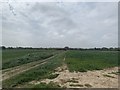
View towards Thanet Way in Field next to Osborne Gardens Beltinge Village
This shot was taken in the field off the back of Osborne Gardens in the Village of Beltinge. On the horizon centre right you can see Sainsbury's and the Thanet Way overpass. This view will soon be impossible as developers are building another 1,300 home estate on this field. Villagers are campaigning to build a bypass bridge near the Thanet Way to divert the mass traffic from this development away from the town.
Image: © Matt Allsop
Taken: 17 Apr 2020
0.07 miles
8
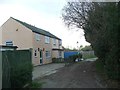
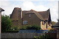
The Oast House, Margate Road, Herne Bay, Kent
Image: © Oast House Archive
Taken: 17 Apr 2009
0.16 miles
9
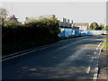
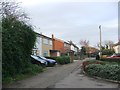
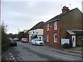
Looking west across Margate Road
Planning permission has been granted by Canterbury City Council under application number CA//14/00058 for the “erection of 8 dwellings on the land adjacent to the Huntsman & Horn Public House”. Two of them are visible in this view.
Nick Smith’s Image shows the road before any buildings had appeared in the distance.
Image: © John Baker
Taken: 25 Jan 2016
0.16 miles
10

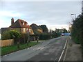
Beltinge from the air
At the east end of Herne Bay.
Image: © Thomas Nugent
Taken: 14 Sep 2015
0.18 miles