IMAGES TAKEN NEAR TO
Arolla Road, HERNE BAY, CT6 6BW
Introduction
This page details the photographs taken nearby to Arolla Road, CT6 6BW by members of the Geograph project.
The Geograph project started in 2005 with the aim of publishing, organising and preserving representative images for every square kilometre of Great Britain, Ireland and the Isle of Man.

There are currently over 7.5m images from over14,400 individuals and you can help contribute to the project by visiting https://www.geograph.org.uk
Image Map
Images are licensed for reuse under creativecommons.org/licenses/by-sa/2.0
Notes
- Clicking on the map will re-center to the selected point.
- The higher the marker number, the further away the image location is from the centre of the postcode.
Image Listing (23 Images Found)
Images are licensed for reuse under creativecommons.org/licenses/by-sa/2.0
Image
Details
Distance
1
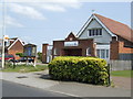
Beltinge Baptist Church
Serving a suburb on the eastern side of Herne Bay.
Image: © Jonathan Billinger
Taken: 25 Apr 2007
0.06 miles
7
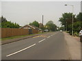
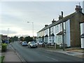
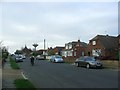
Reculver Road
This road leads from Mickleburgh Hill and Margate Road towards Beltinge and Bishopstone.
Image: © David Anstiss
Taken: 5 Jun 2010
0.17 miles
10
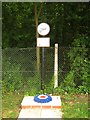
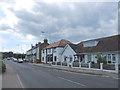
Memorial to Albert Hugo Friday
On Reculver Road close to the junction with the B2205 Mickleburgh Hill. In the background is the Herne Bay to Margate/Ramsgate Railway.
See also Image Close-up of plaques on the memorial.
Image: © David Anstiss
Taken: 5 Jun 2010
0.20 miles