IMAGES TAKEN NEAR TO
Dering Close, CANTERBURY, CT4 5ND
Introduction
This page details the photographs taken nearby to Dering Close, CT4 5ND by members of the Geograph project.
The Geograph project started in 2005 with the aim of publishing, organising and preserving representative images for every square kilometre of Great Britain, Ireland and the Isle of Man.

There are currently over 7.5m images from over14,400 individuals and you can help contribute to the project by visiting https://www.geograph.org.uk
Image Map
Images are licensed for reuse under creativecommons.org/licenses/by-sa/2.0
Notes
- Clicking on the map will re-center to the selected point.
- The higher the marker number, the further away the image location is from the centre of the postcode.
Image Listing (102 Images Found)
Images are licensed for reuse under creativecommons.org/licenses/by-sa/2.0
Image
Details
Distance
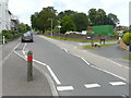
1
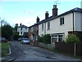
Aunt Betsy's Hill, Dering Road, Bridge
Image: © Chris Whippet
Taken: 29 May 2015
0.03 miles
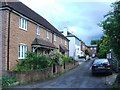
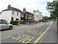
3
12, High Street
Scaffolding has been erected on the frontage of this grade II listed building. It dates from the early 19th century and is described as a three storey house in stucco with parapet and cornice
http://www.britishlistedbuildings.co.uk/en-171012-10-and-12-high-street-bridge-kent It can also been seen in this view of the Image looking much the same.
Image: © John Baker
Taken: 21 Sep 2014
0.06 miles
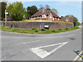
4
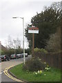
Bridge Village Sign
On the junction of High Street (on the left) and Conyngham Lane (on the right).
The village takes its name from a series of bridges over the River Nailbourne.
Image: © David Anstiss
Taken: 26 Mar 2010
0.07 miles
5
Looking north-northwest along the High Street
On the right, the green storage containers are on a Image
Image: © John Baker
Taken: 26 Jun 2016
0.07 miles
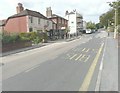
7
Looking west-northwest along the High Street
To where a structure of scaffolding and polythene sheeting completely covers the post office building.
Image: © John Baker
Taken: 19 Apr 2015
0.07 miles
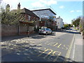
8
Post Office, High Street
Compared with Image, the post office, which was then covered by a structure of scaffolding and polythene sheeting, now appears to be in a pristine condition.
Image: © John Baker
Taken: 26 Jun 2016
0.07 miles
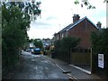
9
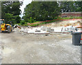
Building site, Conyngham Lane
Planning permission has been granted by Canterbury City Council under application number CA//15/02421 for a "proposed replacement dwelling and detached garage". The former house was called Beechmount.
Image: © John Baker
Taken: 26 Jun 2016
0.08 miles
10
Beechmount, Conyngham Lane
Image: © John Baker
Taken: 16 Apr 2020
0.08 miles