IMAGES TAKEN NEAR TO
School Road, CANTERBURY, CT3 2JD
Introduction
This page details the photographs taken nearby to School Road, CT3 2JD by members of the Geograph project.
The Geograph project started in 2005 with the aim of publishing, organising and preserving representative images for every square kilometre of Great Britain, Ireland and the Isle of Man.

There are currently over 7.5m images from over14,400 individuals and you can help contribute to the project by visiting https://www.geograph.org.uk
Image Map
Images are licensed for reuse under creativecommons.org/licenses/by-sa/2.0
Notes
- Clicking on the map will re-center to the selected point.
- The higher the marker number, the further away the image location is from the centre of the postcode.
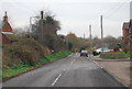
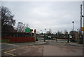
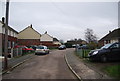
Image Listing (50 Images Found)
Images are licensed for reuse under creativecommons.org/licenses/by-sa/2.0
Image
Details
Distance
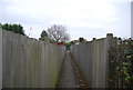
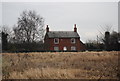
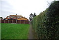
8
The end of Molland Lane, Ash
Molland Lane originally continued along this route but a new road cuts through and the lane was closed to through traffic, now only a bridleway continues.
Image: © Nick Smith
Taken: 19 Jan 2007
0.09 miles