IMAGES TAKEN NEAR TO
Chillenden, CANTERBURY, CT3 1QE
Introduction
This page details the photographs taken nearby to CT3 1QE by members of the Geograph project.
The Geograph project started in 2005 with the aim of publishing, organising and preserving representative images for every square kilometre of Great Britain, Ireland and the Isle of Man.

There are currently over 7.5m images from over14,400 individuals and you can help contribute to the project by visiting https://www.geograph.org.uk
Image Map
Images are licensed for reuse under creativecommons.org/licenses/by-sa/2.0
Notes
- Clicking on the map will re-center to the selected point.
- The higher the marker number, the further away the image location is from the centre of the postcode.
Image Listing (11 Images Found)
Images are licensed for reuse under creativecommons.org/licenses/by-sa/2.0
Image
Details
Distance
1
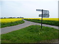
Crossroads near Goodnestone
To the left is Goodnestone, on the right is Rowling and straight on leads to Wingham. The road in the foreground leads to Chillenden.
Image: © pam fray
Taken: 21 Sep 2009
0.04 miles
2
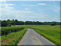
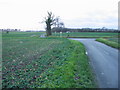
Lane towards Goodnestone
Wheat on the left, barley on the right.
Image: © Robin Webster
Taken: 12 Jun 2014
0.08 miles
3
Crossroads near Chillenden Windmill
Chillenden Windmill is passed along the road to the right.
Image: © Marathon
Taken: 2 May 2015
0.08 miles
4
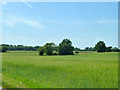
Field of barley
An area with no or fragmented hedgerows. The two darker lines crossing the fields to the left are lanes.
Image: © Robin Webster
Taken: 12 Jun 2014
0.10 miles
5
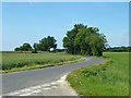
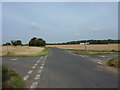
Road towards Wingham
Looking from the crossroads with the Eastry - Goodnestone route.
Image: © Robin Webster
Taken: 12 Jun 2014
0.11 miles
6
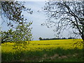
Oilseed rape near Chillenden
The trees surrounding Rowling House and Upper Rowling Farm can be seen in the distance. This is the view from the lane between Claypits and Chillenden Windmill.
Image: © Marathon
Taken: 2 May 2015
0.15 miles
7
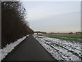
Looking SW along Buckland Lane and junction with Cave Lane
Image: © Nick Smith
Taken: 1 Dec 2007
0.21 miles
8

Catsole Hill leading into the village of Goodnestone
Image: © pam fray
Taken: 21 Sep 2009
0.22 miles
9
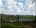
Swing gate accessing the footpath to Goodnestone
By the side of Catsole Hill.
Image: © pam fray
Taken: 30 Apr 2021
0.23 miles
10
Buckland Lane past Long Wood
This lane leads from Love Lane, around Goodnestone Park (and Long Wood) heading towards Staple.
Crixall Rough (wood) is in the far background.
Image: © David Anstiss
Taken: 26 Dec 2010
0.23 miles