IMAGES TAKEN NEAR TO
Rowling, CANTERBURY, CT3 1QB
Introduction
This page details the photographs taken nearby to Rowling, CT3 1QB by members of the Geograph project.
The Geograph project started in 2005 with the aim of publishing, organising and preserving representative images for every square kilometre of Great Britain, Ireland and the Isle of Man.

There are currently over 7.5m images from over14,400 individuals and you can help contribute to the project by visiting https://www.geograph.org.uk
Image Map
Images are licensed for reuse under creativecommons.org/licenses/by-sa/2.0
Notes
- Clicking on the map will re-center to the selected point.
- The higher the marker number, the further away the image location is from the centre of the postcode.
Image Listing (9 Images Found)
Images are licensed for reuse under creativecommons.org/licenses/by-sa/2.0
Image
Details
Distance
1
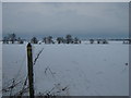
Footpath to Summerfield Farm
A footpath leads from a lane near Upper Rowling Farm to a lane near Summerfield Farm.
Image: © David Anstiss
Taken: 19 Dec 2010
0.06 miles
2
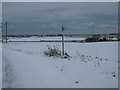
Footpath past Rowling Court
A footpath leads from a lane near Upper Rowling Farm to a lane near Rowling Court. Meadow Cottages are on the right
Image: © David Anstiss
Taken: 19 Dec 2010
0.07 miles
3
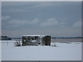
Pillbox near Upper Rowling Farm
As seen from a footpath from Summerfield Farm to the Upper Rowling Farm.
View towards Eastry which is in the background.
Image: © David Anstiss
Taken: 19 Dec 2010
0.08 miles
4
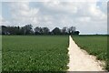
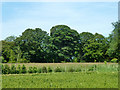
Path to Upper Rowling Farm, Rowling
Near Goodnestone.
Image: © pam fray
Taken: 30 Apr 2021
0.09 miles
6
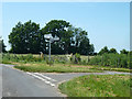
Lane junction west of Upper Rowling Farm
Image: © Robin Webster
Taken: 12 Jun 2014
0.15 miles
7
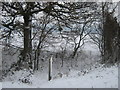
Footpath crosses Green Lane
A footpath from Upper Rowling Farm leads over an ancient track (leading towards Rowling House), before heading to Summerfield Farm.
Image: © David Anstiss
Taken: 19 Dec 2010
0.20 miles
8
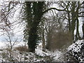
Green Lane
This ancient track leads from Rowling House to a lane, which then leads to a byway to Eastry.
Image: © David Anstiss
Taken: 19 Dec 2010
0.22 miles
9
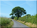
Lane towards Goodnestone
The footpath takes a short cut to Upper Rowling Farm.
Image: © Robin Webster
Taken: 12 Jun 2014
0.24 miles