IMAGES TAKEN NEAR TO
Wingham Well Lane, CANTERBURY, CT3 1NT
Introduction
This page details the photographs taken nearby to Wingham Well Lane, CT3 1NT by members of the Geograph project.
The Geograph project started in 2005 with the aim of publishing, organising and preserving representative images for every square kilometre of Great Britain, Ireland and the Isle of Man.

There are currently over 7.5m images from over14,400 individuals and you can help contribute to the project by visiting https://www.geograph.org.uk
Image Map
Images are licensed for reuse under creativecommons.org/licenses/by-sa/2.0
Notes
- Clicking on the map will re-center to the selected point.
- The higher the marker number, the further away the image location is from the centre of the postcode.
Image Listing (15 Images Found)
Images are licensed for reuse under creativecommons.org/licenses/by-sa/2.0
Image
Details
Distance
1
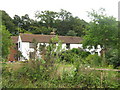
Neavy Cottages
As seen from Snakes Hill.
Image: © David Anstiss
Taken: 15 Aug 2010
0.00 miles
2
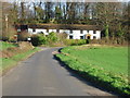
Cottages at junction of Snakes Hill and Wingham Well Lane
Image: © Nick Smith
Taken: 14 Jan 2007
0.01 miles
3
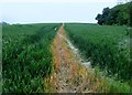
Footpath to Wingham
Public footpath EE176 through corn field.
Image: © Peter Holmes
Taken: 30 May 2016
0.04 miles
4
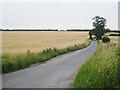
Wingham Well Lane
Towards Bramling and Bekesbourne.
Image: © Oast House Archive
Taken: 20 Jul 2010
0.06 miles
5
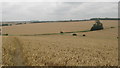
View from Neavy Downs
Looking from the downland footpath towards Wingham Well Lane.
In the next field a bridleway can be seen heading towards Bossington Farm.
Image: © David Anstiss
Taken: 15 Aug 2010
0.07 miles
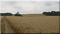
6
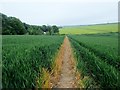
Footpath to Wingham Well Lane
Public footpath EE176 through corn field with view of Neavy Downs.
Image: © Peter Holmes
Taken: 30 May 2016
0.07 miles
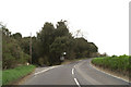
7
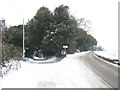
Road junction on the Adisham Road
The B2046 Adisham Road (has been cleared of snow) heads right towards Wingham.
Wingham Well Lane leads left and down an icy path towards Wingham Well.
Compare with Image in Summer.
Image: © David Anstiss
Taken: 19 Dec 2010
0.13 miles
8
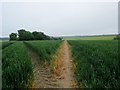
Footpath with view of woodlands by Snakes Hill
Public footpath EE176 through corn field.
Image: © Peter Holmes
Taken: 30 May 2016
0.14 miles
10
View of Neavy Downs
As seen from a bridleway from Bossington Farm towards Wingham Well Lane.
On the right is the downland near Wingham.
Compare with Image
Image: © David Anstiss
Taken: 15 Aug 2010
0.15 miles