IMAGES TAKEN NEAR TO
Canterbury Road, CANTERBURY, CT3 1NH
Introduction
This page details the photographs taken nearby to Canterbury Road, CT3 1NH by members of the Geograph project.
The Geograph project started in 2005 with the aim of publishing, organising and preserving representative images for every square kilometre of Great Britain, Ireland and the Isle of Man.

There are currently over 7.5m images from over14,400 individuals and you can help contribute to the project by visiting https://www.geograph.org.uk
Image Map
Images are licensed for reuse under creativecommons.org/licenses/by-sa/2.0
Notes
- Clicking on the map will re-center to the selected point.
- The higher the marker number, the further away the image location is from the centre of the postcode.
Image Listing (32 Images Found)
Images are licensed for reuse under creativecommons.org/licenses/by-sa/2.0
Image
Details
Distance
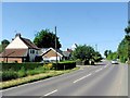
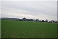
2
View N across fields towards houses on A257 near Wingham
Image: © Nick Smith
Taken: 7 Dec 2007
0.03 miles
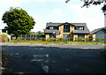
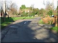
3
Field, Canterbury Road
Planning permission has been granted by Canterbury City Council under application number 19/00462 for the “erection of a detached dwelling, formation of new vehicle access and parking”.
The planning notice has been affixed to the gate.
A house named Image was subsequently built on the site.
Image: © John Baker
Taken: 14 Jun 2020
0.04 miles
4
Copperfields, Canterbury Road
The house was built in a Image
Image: © John Baker
Taken: 17 Jul 2022
0.04 miles

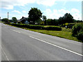
7
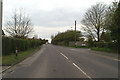
The road to Ickham & Wickhambreaux
On the A257 out of Wingham
Image: © David Long
Taken: 20 Apr 2006
0.11 miles
9
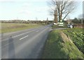
Canterbury Road (A257)
On the right is the entrance to The Little Railway Farm Shop, which in the days of the East Kent Light Railway would have been the point at which the railway crossed the road to terminate at Wingham Canterbury Road station. Further rail plans had been drawn up in the 1930s and preliminary work was started on a line to run from this station to Chislet Colliery via Stodmarsh but their plans did not come to fruition. The railway opened on 16 October 1916 and closed completely on 1 March 1951. Although the text of the link indicates that there is no evidence on the ground of the cutting beyond the station, one can discern its faint outline from the air http://www.disused-stations.org.uk/w/wingham_canterbury_road/index.shtml
Image: © John Baker
Taken: 31 Jan 2013
0.13 miles
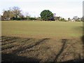
10
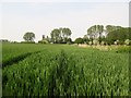
Corn Field
Looking towards Fairview Nursery.
Image: © Peter Holmes
Taken: 29 May 2016
0.14 miles