IMAGES TAKEN NEAR TO
Becket Business Park, Broad Oak Road, CANTERBURY, CT2 0PQ
Introduction
This page details the photographs taken nearby to Becket Business Park, Broad Oak Road, CT2 0PQ by members of the Geograph project.
The Geograph project started in 2005 with the aim of publishing, organising and preserving representative images for every square kilometre of Great Britain, Ireland and the Isle of Man.

There are currently over 7.5m images from over14,400 individuals and you can help contribute to the project by visiting https://www.geograph.org.uk
Image Map
Images are licensed for reuse under creativecommons.org/licenses/by-sa/2.0
Notes
- Clicking on the map will re-center to the selected point.
- The higher the marker number, the further away the image location is from the centre of the postcode.
Image Listing (45 Images Found)
Images are licensed for reuse under creativecommons.org/licenses/by-sa/2.0
Image
Details
Distance
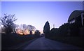
2
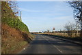
Broad Oak Road
Broad Oak Road leads into Canterbury from Broad Oak. This is just past Broadoak Level Crossing. It is a busy road as many drivers use it to avoid the frequent jams at the level crossing next to Sturry station.
Image: © Marathon
Taken: 13 Aug 2016
0.04 miles
3
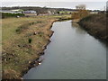
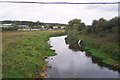
Great Stour, looking downstream
Viewed from the bridge on Vauxhall Road, the Great Stour is quite scruffy at this point, lots of rubbish and debris both in the water and on the banks.
Image: © Nick Smith
Taken: 31 Dec 2007
0.06 miles
4
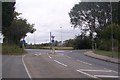
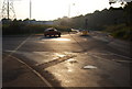
Roundabout on Broad Oak Road
Broak Oak Road from Canterbury, heads straight on towards Broad Oak and Herne Bay. Vauxhall Road leads right towards Sturry Road.
Image: © David Anstiss
Taken: 30 Sep 2009
0.07 miles
5
River Great Stour leading toward Sturry
Seen from Vauxhall Road bridge. Broad Oak level crossing is seen in the background.
Image: © David Anstiss
Taken: 30 Sep 2009
0.07 miles
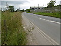
6
Shalloak Rd approaching Broad Oak Crossing
Image: © N Chadwick
Taken: 10 Dec 2011
0.08 miles
8
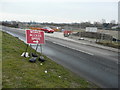
Works access BM05, Broad Oak Road
One of three temporary access points to the Image
Image: © John Baker
Taken: 14 Jan 2018
0.08 miles
9
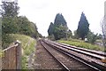
Railway to Sturry
This line leads from Canterbury West towards Sturry and then onto Minister and Margate. It is seen from the level crossing near Broad Oak. The Shalloak Road Crossing is just seen in the background.
Image: © David Anstiss
Taken: 30 Sep 2009
0.08 miles
10
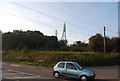
Electricity pylons crossing the railway line
Image: © N Chadwick
Taken: 27 Sep 2008
0.09 miles