IMAGES TAKEN NEAR TO
Sandgate Esplanade, FOLKESTONE, CT20 3DZ
Introduction
This page details the photographs taken nearby to Sandgate Esplanade, CT20 3DZ by members of the Geograph project.
The Geograph project started in 2005 with the aim of publishing, organising and preserving representative images for every square kilometre of Great Britain, Ireland and the Isle of Man.

There are currently over 7.5m images from over14,400 individuals and you can help contribute to the project by visiting https://www.geograph.org.uk
Image Map
Images are licensed for reuse under creativecommons.org/licenses/by-sa/2.0
Notes
- Clicking on the map will re-center to the selected point.
- The higher the marker number, the further away the image location is from the centre of the postcode.
Image Listing (156 Images Found)
Images are licensed for reuse under creativecommons.org/licenses/by-sa/2.0
Image
Details
Distance
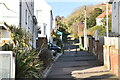
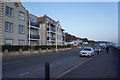
1
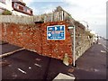
Sandgate, Brewer's Hill
Sandgate, Sandgate Esplanade, A259, Brewer's Hill.
Image: © Helmut Zozmann
Taken: 20 Jul 2012
0.00 miles
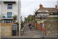
3
Sandgate, Brewer's Hill
Sandgate, Sandgate Esplanade, A259, Brewer's Hill.
Image: © Helmut Zozmann
Taken: 20 Jul 2012
0.01 miles
6
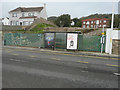
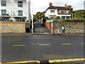
Building site, Sandgate Esplanade
Planning permission has been approved, with conditions, by Folkestone and Hythe District Council under application number Y15/0112/SH for a “section 73 application to vary condition 2 of planning permission Y11/0537/SH for the erection of two, four storey blocks comprising ten flats in total, following excavation of the site together with parking below and associated engineering works, in order to allow an increase in the overall height of the building by 750mm, reduce the lower ground floor area of the building, and omit the tandem parking layout, provide increased refuse storage and secure cycle provision. The location was given as land adjoining West Wedge (a house to the right of the site, not shown here).
Image: © John Baker
Taken: 8 Nov 2015
0.02 miles
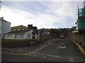
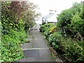
10
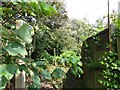
Sandgate, Brewer's Hill
Sandgate, Brewer's Hill, Public Footpath No. HF64.
Image: © Helmut Zozmann
Taken: 20 Jul 2012
0.03 miles