1
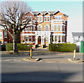
Grimston Avenue
At junction with Shorncliffe Road.
Image: © Oast House Archive
Taken: 8 Apr 2010
0.12 miles
2
Conversion of Roann House, 91, Bouverie Road West
Prior approval was approved by Folkestone and Hythe District Council under application number Y14/0010/BGPD for the “determination as to whether the prior approval of the Local Authority is required under Class K of the Town and Country Planning (General Permitted Development) (Amendment) (England) Order 2013 for the change of use and conversion from nursing home (Class C2) to nursery (Class D1)”.
Image: © John Baker
Taken: 5 Mar 2017
0.13 miles
3
58 - 60 & 62, Shorncliffe Road
Planning permission has been approved, with conditions, by Folkestone and Hythe District Council under application number Y14/1149/SH for the “proposed residential development of 42 flats arranged in three separate four-storey buildings, following the demolition of the existing structures and including the creation of associated vehicular accesses”. Number 62 is the house to the left of the semi-detached house, which is numbered 58 and 60.
Image: © John Baker
Taken: 10 Dec 2015
0.14 miles
4
58-60, Shorncliffe Road
This was
Image in January 2018. Note how the lamppost has been removed since that date.
Image: © John Baker
Taken: 1 Mar 2020
0.14 miles
5
Building site, 54 & 56, Shorncliffe Road
Planning permission was approved, with conditions, by Folkestone and Hythe District Council under application number Y15/0563/SH as a “section 73 application for the variation of conditions 4, 6, 21 and 29 of outline planning permission Y10/0077/SH (outline application for the construction of 127 dwellings (Class C3) and an 80 bedroom nursing home (Class C2) following the demolition of 52 Shorncliffe Road, together with associated access, parking and landscaping) in order to allow amendments to the approved layout, landscaping and the number of units (condition 4); samples of the proposed materials to be submitted prior to the commencement of development (condition 6); and minor re-wording of conditions 21 and 29 to reflect the commencement of the approved care home”.
This was the
Image in January 2018.
Image: © John Baker
Taken: 1 Mar 2020
0.15 miles
6
Building site, 54 & 56, Shorncliffe Road
Planning permission was approved, with conditions, by Folkestone and Hythe District Council under application number Y15/0563/SH as a “section 73 application for the variation of conditions 4, 6, 21 and 29 of outline planning permission Y10/0077/SH (outline application for the construction of 127 dwellings (Class C3) and an 80 bedroom nursing home (Class C2) following the demolition of 52 Shorncliffe Road, together with associated access, parking and landscaping) in order to allow amendments to the approved layout, landscaping and the number of units (condition 4); samples of the proposed materials to be submitted prior to the commencement of development (condition 6); and minor re-wording of conditions 21 and 29 to reflect the commencement of the approved care home”.
This image shows
Image before the building was demolished.
Image: © John Baker
Taken: 4 Jan 2018
0.15 miles
7
54 & 56, Shorncliffe Road
The building forms part of a
Image and it would seem, from the presence of scaffolding and hoarding, that it is being demolished.
Image: © John Baker
Taken: 27 Aug 2017
0.15 miles
8
54 & 56, Shorncliffe Road
This was formerly Westbrook House Preparatory School. Planning permission has been approved, with conditions, by Folkestone and Hythe District Council under application number Y15/0563/SH for a “section 73 application for the variation of conditions 4, 6, 21 and 29 of outline planning permission Y10/0077/SH (outline application for the construction of 127 dwellings (Class C3) and an 80 bedroom nursing home (Class C2) following the demolition of 52 Shorncliffe Road (together with associated access, parking and landscaping) in order to allow amendments to the approved layout, landscaping and the number of units (condition 4)); samples of the proposed materials to be submitted prior to the commencement of development (condition 6); and minor re-wording of conditions 21 and 29 to reflect the commencement of the approved care home”.
52, Shorncliffe Road was formerly St Mary’s Westbrook School.
Image: © John Baker
Taken: 10 Dec 2015
0.15 miles
9
58-60, Shorncliffe Road
Planning permission was approved, with conditions, by Folkestone and Hythe District Council under application number Y17/0684/SH for the “change of use and conversion from former school building to eight flats, with minor external alterations and associated vehicle parking".
Image: © John Baker
Taken: 4 Jan 2018
0.15 miles
10
Lyn Court, Shorncliffe Road
The scaffolding that has been erected, on parts of the frontage of the building, indicates that alterations are being made to it. Note: the boarded up windows on the left side of the building.
Image: © John Baker
Taken: 10 Dec 2015
0.15 miles


