IMAGES TAKEN NEAR TO
Westfield Lane, FOLKESTONE, CT18 8BZ
Introduction
This page details the photographs taken nearby to Westfield Lane, CT18 8BZ by members of the Geograph project.
The Geograph project started in 2005 with the aim of publishing, organising and preserving representative images for every square kilometre of Great Britain, Ireland and the Isle of Man.

There are currently over 7.5m images from over14,400 individuals and you can help contribute to the project by visiting https://www.geograph.org.uk
Image Map
Images are licensed for reuse under creativecommons.org/licenses/by-sa/2.0
Notes
- Clicking on the map will re-center to the selected point.
- The higher the marker number, the further away the image location is from the centre of the postcode.
Image Listing (47 Images Found)
Images are licensed for reuse under creativecommons.org/licenses/by-sa/2.0
Image
Details
Distance
1
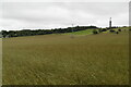
A View towards Ethchinghill
A view towards the village from the northern flanks of Tolsford Hill.
Image: © Chris Heaton
Taken: 13 Sep 2010
0.12 miles
3
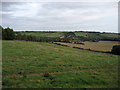
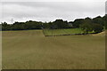
Looking W across farmland from the Elham Valley Way
Image: © Nick Smith
Taken: 6 Sep 2008
0.13 miles
6
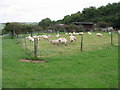
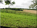
Small field of sheep at the end of Westfield Lane
Image: © Nick Smith
Taken: 6 Sep 2008
0.17 miles
7
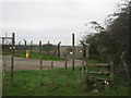
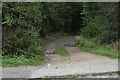
Stiles at Swingfield Radio Mast
Three long distance paths lead from The Beaches (woodland) near Etchinghill, towards the Mast on Tolsford Hill, over an access road to the mast.
The North Downs Way heads towards Postling Common.
The Saxon Shore Way heads towards Bluehouse Lane and the A20.
The Elham Valley Way heads towards Lyminge.
Image: © David Anstiss
Taken: 13 Nov 2010
0.18 miles
8
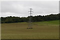
Footpath near Swingfield Radio Mast
Three long distance paths lead from the Mast on Tolsford Hill towards The Beaches (woodland) near Etchinghill.
The North Downs Way heads from Postling Common.
The Saxon Shore Way heads from Bluehouse Lane and the A20.
The Elham Valley Way heads from Lyminge.
Note; the MOD mentions a bridleway, but none is used.
Image: © David Anstiss
Taken: 13 Nov 2010
0.18 miles
9
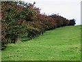
Row of hawthorn bushes on the Elham Valley Way
The trees appear red from a distance due to the heavy crop of berries.
Image: © Nick Smith
Taken: 6 Sep 2008
0.18 miles