IMAGES TAKEN NEAR TO
Fraser Way, FOLKESTONE, CT18 7SJ
Introduction
This page details the photographs taken nearby to Fraser Way, CT18 7SJ by members of the Geograph project.
The Geograph project started in 2005 with the aim of publishing, organising and preserving representative images for every square kilometre of Great Britain, Ireland and the Isle of Man.

There are currently over 7.5m images from over14,400 individuals and you can help contribute to the project by visiting https://www.geograph.org.uk
Image Map
Images are licensed for reuse under creativecommons.org/licenses/by-sa/2.0
Notes
- Clicking on the map will re-center to the selected point.
- The higher the marker number, the further away the image location is from the centre of the postcode.
Image Listing (7 Images Found)
Images are licensed for reuse under creativecommons.org/licenses/by-sa/2.0
Image
Details
Distance
1
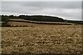
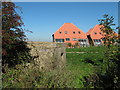
Not near the Great Western Railway
As seen from Gibraltar Lane. This lane leads to several houses near Argrove Wood.
Note: the Great Western Railway is nowhere near here!
Image: © David Anstiss
Taken: 10 Oct 2010
0.08 miles

5
Pillbox near Gibraltar Lane
This bunker is a leftover from the World War II, in the background are (the hideous roofs) of a new housing development being built on the former Battle of Britain Airfield.
Image: © David Anstiss
Taken: 10 Oct 2010
0.10 miles
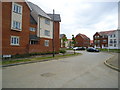
6
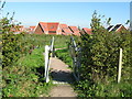
New footpath into Hawkinge Housing Development
Leading from Gibraltar Lane is a footpath around a landscaped section around the large housing estate.
Image: © David Anstiss
Taken: 10 Oct 2010
0.17 miles