IMAGES TAKEN NEAR TO
Satmar Lane, FOLKESTONE, CT18 7JF
Introduction
This page details the photographs taken nearby to Satmar Lane, CT18 7JF by members of the Geograph project.
The Geograph project started in 2005 with the aim of publishing, organising and preserving representative images for every square kilometre of Great Britain, Ireland and the Isle of Man.

There are currently over 7.5m images from over14,400 individuals and you can help contribute to the project by visiting https://www.geograph.org.uk
Image Map
Images are licensed for reuse under creativecommons.org/licenses/by-sa/2.0
Notes
- Clicking on the map will re-center to the selected point.
- The higher the marker number, the further away the image location is from the centre of the postcode.
Image Listing (18 Images Found)
Images are licensed for reuse under creativecommons.org/licenses/by-sa/2.0
Image
Details
Distance
1
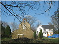
Capel House Farm
On Satmar Lane. In the foreground a catholic shrine.
Image: © David Anstiss
Taken: 27 Feb 2011
0.03 miles
2
The busy junction of Winehouse Lane and Satmar Lane
Busy because of vehicles accessing the campsite located at the junction.
Image: © Carol Rose
Taken: 4 May 2007
0.13 miles
3

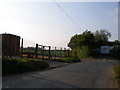
Pumping Station, Winehouse Lane
Operated by Southern Water
Image: © Tim Heaton
Taken: 8 Aug 2019
0.15 miles
6
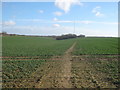
Footpath to Dawkinge Wood
This path leads from Whitehouse Lane towards the wood (in the background) and then right towards Abbot's Land Farm on New Dover Road.
Image: © David Anstiss
Taken: 27 Feb 2011
0.18 miles
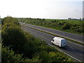
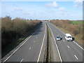
7
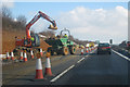
A20 towards Folkestone
Viewed from the Satmar Lane bridge. A few flakes of snow were falling. One is rather near the camera.
Image: © Robin Webster
Taken: 16 Jan 2013
0.19 miles
8
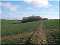
Footpath junction Dawkinge Wood
A path leads from Whitehouse Lane towards the wood. Another path heads right towards Abbot's Land Farm on New Dover Road, or left towards Satmar Lane in Satmar.
Image: © David Anstiss
Taken: 27 Feb 2011
0.19 miles
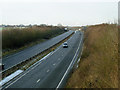
9
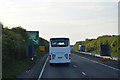
A20 towards Folkestone
As seen from Satmar Lane bridge. This section of the dual carriageway leads from Dover towards Folkestone.
Image: © David Anstiss
Taken: 27 Feb 2011
0.20 miles