IMAGES TAKEN NEAR TO
Nursery Close, FOLKESTONE, CT18 7DT
Introduction
This page details the photographs taken nearby to Nursery Close, CT18 7DT by members of the Geograph project.
The Geograph project started in 2005 with the aim of publishing, organising and preserving representative images for every square kilometre of Great Britain, Ireland and the Isle of Man.

There are currently over 7.5m images from over14,400 individuals and you can help contribute to the project by visiting https://www.geograph.org.uk
Image Map
Images are licensed for reuse under creativecommons.org/licenses/by-sa/2.0
Notes
- Clicking on the map will re-center to the selected point.
- The higher the marker number, the further away the image location is from the centre of the postcode.
Image Listing (18 Images Found)
Images are licensed for reuse under creativecommons.org/licenses/by-sa/2.0
Image
Details
Distance
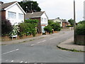
1
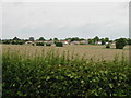
View over the fields to houses on Minter Avenue
Taken from a stile on Pay Street which is on top of the road bank giving views over the hedgerows.
Image: © Nick Smith
Taken: 20 Jun 2008
0.08 miles
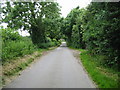
3
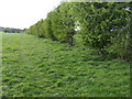
Footpath to Limes Farm
Following the hedge line.
Image: © Jonathan Billinger
Taken: 25 Apr 2007
0.16 miles
6
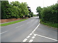
Looking SE along the A260 Canterbury Road towards Hawkinge
Image: © Nick Smith
Taken: 20 Jun 2008
0.16 miles
7
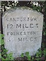
Old Milestone by the A260, south of Densole, Swingfield Parish
Carved stone post by the A260, in parish of SWINGFIELD (SHEPWAY District), Canterbury Road, Densole, opposite No. 289, back of grass verge, against hedge, on East side of road. Barham road stone, erected by the Folkestone & Barham turnpike trust in the 19th century.
Inscription reads:-
CANTERBURY
12 MILES
FOLKESTONE
3½ MILES
Milestone Society National ID: KE_CYFO12.
Image: © C Woodward
Taken: 21 Apr 2008
0.17 miles
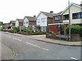
8
Densole, Canterbury Road
Densole, Canterbury Road, A260, 3rd Hawkinge Scout Group.
Image: © Helmut Zozmann
Taken: 2 Aug 2012
0.18 miles
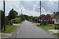
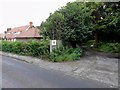
10
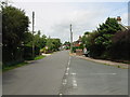
View along Pay Street from junction with St John's Way
Image: © Nick Smith
Taken: 20 Jun 2008
0.19 miles