Old Milestone by the A260, south of Densole, Swingfield Parish
Introduction
The photograph on this page of Old Milestone by the A260, south of Densole, Swingfield Parish by C Woodward as part of the Geograph project.
The Geograph project started in 2005 with the aim of publishing, organising and preserving representative images for every square kilometre of Great Britain, Ireland and the Isle of Man.

There are currently over 7.5m images from over 14,400 individuals and you can help contribute to the project by visiting https://www.geograph.org.uk
Old Milestone by the A260, south of Densole, Swingfield Parish
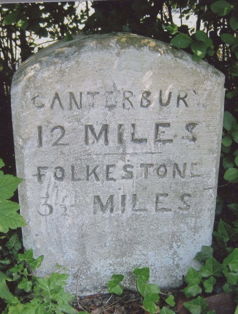
Image: © C Woodward Taken: 21 Apr 2008
Carved stone post by the A260, in parish of SWINGFIELD (SHEPWAY District), Canterbury Road, Densole, opposite No. 289, back of grass verge, against hedge, on East side of road. Barham road stone, erected by the Folkestone & Barham turnpike trust in the 19th century. Inscription reads:- CANTERBURY 12 MILES FOLKESTONE 3½ MILES Milestone Society National ID: KE_CYFO12.
Images are licensed for reuse under creativecommons.org/licenses/by-sa/2.0
Image Location
Latitude
51.125438
Longitude
1.160618