IMAGES TAKEN NEAR TO
Green Lane, DOVER, CT15 7DU
Introduction
This page details the photographs taken nearby to Green Lane, CT15 7DU by members of the Geograph project.
The Geograph project started in 2005 with the aim of publishing, organising and preserving representative images for every square kilometre of Great Britain, Ireland and the Isle of Man.

There are currently over 7.5m images from over14,400 individuals and you can help contribute to the project by visiting https://www.geograph.org.uk
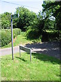
Image Map
Images are licensed for reuse under creativecommons.org/licenses/by-sa/2.0
Notes
- Clicking on the map will re-center to the selected point.
- The higher the marker number, the further away the image location is from the centre of the postcode.
Image Listing (16 Images Found)
Images are licensed for reuse under creativecommons.org/licenses/by-sa/2.0
Image
Details
Distance
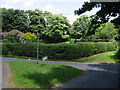
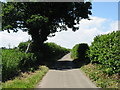
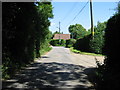
2
Bridleway along Green Lane
The bridleway leads to Alkham along the lane
Image: © Nick Smith
Taken: 28 Jun 2008
0.05 miles
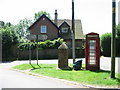
6
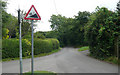
Wolverton Hill - Steep Hill 16%
Wolverton Hill, Ewell Minnis. 16% steep hill up sign, incorrect as the road goes down and with a mirrored % sign.
Image: © Adam Morse
Taken: 30 Jul 2009
0.06 miles
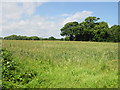
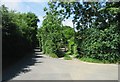
10
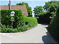
Lane towards Sunnyhill Farm and The Minnis
Image: © Nick Smith
Taken: 28 Jun 2008
0.14 miles