IMAGES TAKEN NEAR TO
Hollands Hill, DOVER, CT15 5LB
Introduction
This page details the photographs taken nearby to Hollands Hill, CT15 5LB by members of the Geograph project.
The Geograph project started in 2005 with the aim of publishing, organising and preserving representative images for every square kilometre of Great Britain, Ireland and the Isle of Man.

There are currently over 7.5m images from over14,400 individuals and you can help contribute to the project by visiting https://www.geograph.org.uk
Image Map
Images are licensed for reuse under creativecommons.org/licenses/by-sa/2.0
Notes
- Clicking on the map will re-center to the selected point.
- The higher the marker number, the further away the image location is from the centre of the postcode.
Image Listing (66 Images Found)
Images are licensed for reuse under creativecommons.org/licenses/by-sa/2.0
Image
Details
Distance
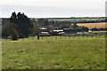
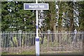
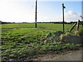
4
Footpath junction near Martin Mill
A path leads from Martin Mill straight on through the field towards a road from White Hill to East Langdon. The other path leading right leads to The Street also in East Langdon.
Image: © David Anstiss
Taken: 27 Mar 2011
0.05 miles
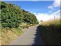
6
Footpaths across the field, near Martin Mill
Image: © Nick Smith
Taken: 1 Dec 2007
0.08 miles