IMAGES TAKEN NEAR TO
Richborough, SANDWICH, CT13 9JW
Introduction
This page details the photographs taken nearby to CT13 9JW by members of the Geograph project.
The Geograph project started in 2005 with the aim of publishing, organising and preserving representative images for every square kilometre of Great Britain, Ireland and the Isle of Man.

There are currently over 7.5m images from over14,400 individuals and you can help contribute to the project by visiting https://www.geograph.org.uk
Image Map
Images are licensed for reuse under creativecommons.org/licenses/by-sa/2.0
Notes
- Clicking on the map will re-center to the selected point.
- The higher the marker number, the further away the image location is from the centre of the postcode.
Image Listing (164 Images Found)
Images are licensed for reuse under creativecommons.org/licenses/by-sa/2.0
Image
Details
Distance
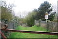
3
![Richborough Roman Fort [7]](https://s3.geograph.org.uk/geophotos/07/06/11/7061199_19ed6b36_120x120.jpg)
Richborough Roman Fort [7]
An information board about a possible late Roman Christian church.
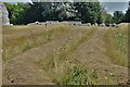
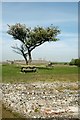
Richborough was used during the entire length of the Roman occupation, from the invasion of AD 43 until the end of Roman rule around 410. Though now inland, at the time of the invasion it lay on the Kent coast, and it was here that the Roman forces first came ashore. The site developed from a beachhead into a military supply base, then into a thriving port town. About 250 the site became a massive fort, one of the Saxon Shore Forts. After the Romans left, a 10th century Anglo-Saxon church was built and the site was occupied until the 15th century. The remains are listed, grade I, with details at: https://historicengland.org.uk/listing/the-list/list-entry/1363256 The site is a Scheduled Ancient Monument and there is much detail and history at: https://historicengland.org.uk/listing/the-list/list-entry/1014642
Image: © Michael Dibb
Taken: 7 Sep 2021
0.03 miles
4
![Richborough Roman Fort [11]](https://s1.geograph.org.uk/geophotos/07/06/12/7061209_5eb4923a_120x120.jpg)
Richborough Roman Fort [11]
An information board about the mid 3rd century earthen fort.
Richborough was used during the entire length of the Roman occupation, from the invasion of AD 43 until the end of Roman rule around 410. Though now inland, at the time of the invasion it lay on the Kent coast, and it was here that the Roman forces first came ashore. The site developed from a beachhead into a military supply base, then into a thriving port town. About 250 the site became a massive fort, one of the Saxon Shore Forts. After the Romans left, a 10th century Anglo-Saxon church was built and the site was occupied until the 15th century. The remains are listed, grade I, with details at: https://historicengland.org.uk/listing/the-list/list-entry/1363256 The site is a Scheduled Ancient Monument and there is much detail and history at: https://historicengland.org.uk/listing/the-list/list-entry/1014642
Image: © Michael Dibb
Taken: 7 Sep 2021
0.03 miles
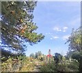
5
![Richborough Roman Fort [12]](https://s2.geograph.org.uk/geophotos/07/06/12/7061218_3b73d2f1_120x120.jpg)
Richborough Roman Fort [12]
The remains of the Mansio or hotel for officials.
Richborough was used during the entire length of the Roman occupation, from the invasion of AD 43 until the end of Roman rule around 410. Though now inland, at the time of the invasion it lay on the Kent coast, and it was here that the Roman forces first came ashore. The site developed from a beachhead into a military supply base, then into a thriving port town. About 250 the site became a massive fort, one of the Saxon Shore Forts. After the Romans left, a 10th century Anglo-Saxon church was built and the site was occupied until the 15th century. The remains are listed, grade I, with details at: https://historicengland.org.uk/listing/the-list/list-entry/1363256 The site is a Scheduled Ancient Monument and there is much detail and history at: https://historicengland.org.uk/listing/the-list/list-entry/1014642
Image: © Michael Dibb
Taken: 7 Sep 2021
0.03 miles
6
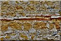
Richborough: Saxon Shore Fort North Wall exterior detail 5
Image: © Michael Garlick
Taken: 26 Jul 2018
0.03 miles
7
Richborough: Saxon Shore Fort North Wall exterior detail 6
Image: © Michael Garlick
Taken: 26 Jul 2018
0.03 miles
8
Richborough Roman Fort: Mid c3rd ditches with mansio and bath-house beyond
Mansio= Official Inn
Image: © Michael Garlick
Taken: 26 Jul 2018
0.04 miles
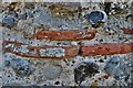
10
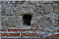
Richborough: Saxon Shore Fort North Wall exterior detail 2
With putlog hole.
Image: © Michael Garlick
Taken: 26 Jul 2018
0.04 miles