Richborough Roman Fort [7]
Introduction
The photograph on this page of Richborough Roman Fort [7] by Michael Dibb as part of the Geograph project.
The Geograph project started in 2005 with the aim of publishing, organising and preserving representative images for every square kilometre of Great Britain, Ireland and the Isle of Man.

There are currently over 7.5m images from over 14,400 individuals and you can help contribute to the project by visiting https://www.geograph.org.uk
Richborough Roman Fort [7]
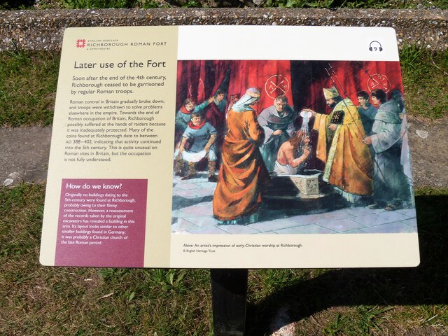
Image: © Michael Dibb Taken: 7 Sep 2021
An information board about a possible late Roman Christian church. Richborough was used during the entire length of the Roman occupation, from the invasion of AD 43 until the end of Roman rule around 410. Though now inland, at the time of the invasion it lay on the Kent coast, and it was here that the Roman forces first came ashore. The site developed from a beachhead into a military supply base, then into a thriving port town. About 250 the site became a massive fort, one of the Saxon Shore Forts. After the Romans left, a 10th century Anglo-Saxon church was built and the site was occupied until the 15th century. The remains are listed, grade I, with details at: https://historicengland.org.uk/listing/the-list/list-entry/1363256 The site is a Scheduled Ancient Monument and there is much detail and history at: https://historicengland.org.uk/listing/the-list/list-entry/1014642
Images are licensed for reuse under creativecommons.org/licenses/by-sa/2.0
Image Location
Latitude
51.293707
Longitude
1.33328