IMAGES TAKEN NEAR TO
Querns Road, CANTERBURY, CT1 1PZ
Introduction
This page details the photographs taken nearby to Querns Road, CT1 1PZ by members of the Geograph project.
The Geograph project started in 2005 with the aim of publishing, organising and preserving representative images for every square kilometre of Great Britain, Ireland and the Isle of Man.

There are currently over 7.5m images from over14,400 individuals and you can help contribute to the project by visiting https://www.geograph.org.uk
Image Map
Images are licensed for reuse under creativecommons.org/licenses/by-sa/2.0
Notes
- Clicking on the map will re-center to the selected point.
- The higher the marker number, the further away the image location is from the centre of the postcode.
Image Listing (181 Images Found)
Images are licensed for reuse under creativecommons.org/licenses/by-sa/2.0
Image
Details
Distance
1
![Canterbury buildings [84]](https://s0.geograph.org.uk/geophotos/07/09/27/7092776_ea0f989a_120x120.jpg)
Canterbury buildings [84]
In Windmill Close at the top of St Martin's Hill stands Quern's Windmill. A tower mill, built in 1816. Constructed of red brick, now rendered under a weatherboarded cap. Listed, grade II, with details at: https://historicengland.org.uk/listing/the-list/list-entry/1242174
Canterbury is a small historic city on the River Stour in Kent, some 54 miles southeast of London. Occupied since prehistoric times, it became an important Roman city. In 672, the see of Canterbury gained authority over the entire English Church. After the murder of Archbishop Thomas Becket at the cathedral in 1170, pilgrims from all parts of Christendom came to visit his shrine until the Dissolution. Today, Canterbury is a popular tourist destination and one of the most-visited cities in the United Kingdom. The city has a substantial student population, with four university campuses.
Image: © Michael Dibb
Taken: 7 Sep 2021
0.05 miles
2
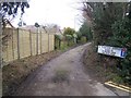
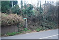
Stour Valley Walk on St Martins Avenue
The long distance path goes along the avenue, heading out of Canterbury.
Image: © David Anstiss
Taken: 18 Feb 2009
0.05 miles
3
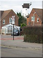
Disused mill on Querns Road
Disused as a windmill but looks like it has been converted as a house.
Image: © Nick Smith
Taken: 31 Dec 2007
0.07 miles
5
![Canterbury features [33]](https://s2.geograph.org.uk/geophotos/07/09/27/7092770_5760a8df_120x120.jpg)
Canterbury features [33]
From St Martin's Hill this public footpath runs, above the churchyard of the church of St Martin to St Martin's Avenue.
Canterbury is a small historic city on the River Stour in Kent, some 54 miles southeast of London. Occupied since prehistoric times, it became an important Roman city. In 672, the see of Canterbury gained authority over the entire English Church. After the murder of Archbishop Thomas Becket at the cathedral in 1170, pilgrims from all parts of Christendom came to visit his shrine until the Dissolution. Today, Canterbury is a popular tourist destination and one of the most-visited cities in the United Kingdom. The city has a substantial student population, with four university campuses.
Image: © Michael Dibb
Taken: 7 Sep 2021
0.10 miles
6
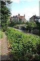
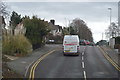
Approaching St. Martin's Hill
Looking along a path leading from St. Martin's Avenue.
Image: © DS Pugh
Taken: 20 Aug 2019
0.10 miles
9
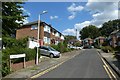
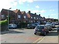
St. Martin's Close
Looking along St. Martin's Close from St. Martin's Avenue.
Image: © DS Pugh
Taken: 20 Aug 2019
0.11 miles
10
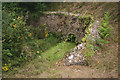
Conduit House, King's Park, Canterbury
This structure is of late C12 origin and is not what one expects to find just off a select close in a Canterbury suburb. It is situated at the point where several streams at the boundary of the Thanet Sands and Chalk join up after being channelled through the four conduits seen here. Their waters then descended by gravity to St Augustine’s Abbey at the foot of the hill. See http://www.english-heritage.org.uk/visit/places/conduit-house/history/ for further details.
Image: © David Kemp
Taken: 7 Aug 2016
0.11 miles