Conduit House, King's Park, Canterbury
Introduction
The photograph on this page of Conduit House, King's Park, Canterbury by David Kemp as part of the Geograph project.
The Geograph project started in 2005 with the aim of publishing, organising and preserving representative images for every square kilometre of Great Britain, Ireland and the Isle of Man.

There are currently over 7.5m images from over 14,400 individuals and you can help contribute to the project by visiting https://www.geograph.org.uk
Conduit House, King's Park, Canterbury
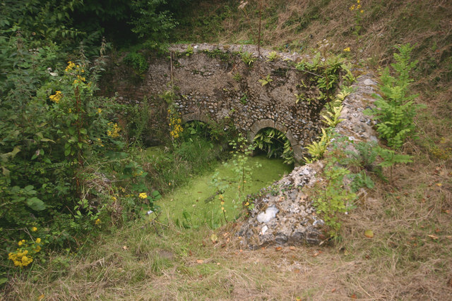
Image: © David Kemp Taken: 7 Aug 2016
This structure is of late C12 origin and is not what one expects to find just off a select close in a Canterbury suburb. It is situated at the point where several streams at the boundary of the Thanet Sands and Chalk join up after being channelled through the four conduits seen here. Their waters then descended by gravity to St Augustine’s Abbey at the foot of the hill. See http://www.english-heritage.org.uk/visit/places/conduit-house/history/ for further details.
Images are licensed for reuse under creativecommons.org/licenses/by-sa/2.0
Image Location
Latitude
51.280369
Longitude
1.095236