IMAGES TAKEN NEAR TO
Ypres Court, CANTERBURY, CT1 1AX
Introduction
This page details the photographs taken nearby to Ypres Court, CT1 1AX by members of the Geograph project.
The Geograph project started in 2005 with the aim of publishing, organising and preserving representative images for every square kilometre of Great Britain, Ireland and the Isle of Man.

There are currently over 7.5m images from over14,400 individuals and you can help contribute to the project by visiting https://www.geograph.org.uk
Image Map
Images are licensed for reuse under creativecommons.org/licenses/by-sa/2.0
Notes
- Clicking on the map will re-center to the selected point.
- The higher the marker number, the further away the image location is from the centre of the postcode.
Image Listing (41 Images Found)
Images are licensed for reuse under creativecommons.org/licenses/by-sa/2.0
Image
Details
Distance
2
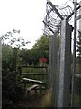
Stile near Howe Barracks
This stile leads from Chaucer Road (leading to the Barracks), beside the perimeter fence towards Scotland Hills and Stodmarsh Road.
Image: © David Anstiss
Taken: 15 Aug 2010
0.14 miles
3
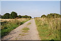
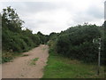
Track across the heath, East of Canterbury
An unusual sight to see heathland vegetation on Chalk!
Image: © N Chadwick
Taken: 27 Sep 2008
0.14 miles
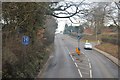
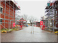
5
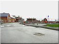
Buffs Road
A similar view of Image was taken in August 2022. The development has been named Royal Parade.
Taken during a photographic outing on Christmas Day afternoon.
Image: © John Baker
Taken: 25 Dec 2022
0.17 miles
6
Buffs Road
This part of the road has been merged with Image The development has been named Royal Parade.
Image: © John Baker
Taken: 28 Aug 2022
0.17 miles
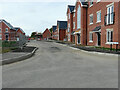
7
Cotter Way
Part of a development named Grand Parade.
Image: © John Baker
Taken: 23 Jul 2023
0.17 miles
8
Cotter Way
A road on a development, which has been named Royal Parade.
Image: © John Baker
Taken: 28 Aug 2022
0.17 miles
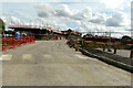
9
Footpath through rough ground near Howe Barracks
A footpath from Canterbury towards Fordwich, leads through some scrub ground also used as training grounds by the army. The track leads around the ground.
Image: © David Anstiss
Taken: 15 Aug 2010
0.18 miles
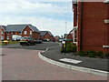
10
Unnamed road
It forms a junction with Buffs Road. The development has been named Royal Parade.
Taken during a photographic outing on Christmas Day afternoon.
Image: © John Baker
Taken: 25 Dec 2022
0.18 miles