IMAGES TAKEN NEAR TO
Colemans Yard, RAMSGATE, CT11 9ED

Introduction

This page details the photographs taken nearby to Colemans Yard, CT11 9ED by members of the Geograph project.

The Geograph project started in 2005 with the aim of publishing, organising and preserving representative images for every square kilometre of Great Britain, Ireland and the Isle of Man.

There are currently over 7.5m images from over14,400 individuals and you can help contribute to the project by visiting https://www.geograph.org.uk

Image Map


Images are licensed for reuse under creativecommons.org/licenses/by-sa/2.0
Notes
  • Clicking on the map will re-center to the selected point.
  • The higher the marker number, the further away the image location is from the centre of the postcode.

Image Listing (643 Images Found)

Images are licensed for reuse under creativecommons.org/licenses/by-sa/2.0
  • ...
Image
Details
Distance
1
Coleman?s Yard carpark
This is the entrance from Queen Street but one can also access it from Cavendish Street. The large building, behind the hoarding, was a former police station.
Image: © John Baker Taken: 9 Nov 2014
0.00 miles
2
Queen Street, Ramsgate
Taken from King Street near to junction of High Street (to the right) and Harbour Street (to the left).
Image: © John Baker Taken: 27 Dec 2009
0.01 miles
3
Colemans Yard, Ramsgate
Image: © Chris Whippet Taken: 2 Aug 2015
0.01 miles
4
Coleman?s Yard
This is the entrance from Queen Street. The large building, in the process of being built, is a block of flats. Planning permission has been granted by Thanet District Council under application number F/TH/10/0573 for the “redevelopment of Court House site and conversion and extension of former Police Station to provide 82 one, two and three bedroom flats in a four and five storey building without compliance with condition 9 of planning permission OL/TH/04/1089”. The work of construction has spread into the former carpark. This was Image in November 2014.
Image: © John Baker Taken: 22 Mar 2020
0.02 miles
5
Kings, 41, Queen Street
Kings is a gentlemen’s hairdresser; the premises used to be Image Note the customer having his hair cut.
Image: © John Baker Taken: 22 Mar 2020
0.02 miles
6
Miles & Barr Lettings, 47-49, Queen Street
Three notices (one on the entrance door and two in the windows) inform members of the public that the estate agents have moved to a new larger refurbished office across the road at Image
Image: © John Baker Taken: 18 Apr 2021
0.02 miles
7
Effingham Street, Ramsgate
Image: © Chris Whippet Taken: 2 Aug 2015
0.02 miles
8
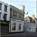
Listed Buildings, Queen Street, Ramsgate
The nearer building – see also https://www.geograph.org.uk/photo/7280451 was built around 1898 for a local wine merchant. The house on the far corner is older, mid 18th century with possibly a timber frame. Both Listed Grade II.
Image: © Alan Murray-Rust Taken: 3 Sep 2022
0.03 miles
9
51 Queen Street, Ramsgate
A distinctive building, built c.1898 by architect W J Jennings of Canterbury for Gwyn and Co, who were wine and spirit merchants. Currently occupied by a firm of estate agents. Listed Grade II.
Image: © Alan Murray-Rust Taken: 3 Sep 2022
0.03 miles
10
Coleman?s Yard
This is the entrance from Queen Street. The large building, in the process of being built, is a block of flats. Planning permission has been granted by Thanet District Council under application number F/TH/10/0573 for the “redevelopment of Court House site and conversion and extension of former Police Station to provide 82 one, two and three bedroom flats in a four and five storey building without compliance with condition 9 of planning permission OL/TH/04/1089”. This view of Image was taken in March 2020.
Image: © John Baker Taken: 18 Apr 2021
0.03 miles
  • ...