IMAGES TAKEN NEAR TO
Swinburne Avenue, BROADSTAIRS, CT10 2DP
Introduction
This page details the photographs taken nearby to Swinburne Avenue, CT10 2DP by members of the Geograph project.
The Geograph project started in 2005 with the aim of publishing, organising and preserving representative images for every square kilometre of Great Britain, Ireland and the Isle of Man.

There are currently over 7.5m images from over14,400 individuals and you can help contribute to the project by visiting https://www.geograph.org.uk
Image Map
Images are licensed for reuse under creativecommons.org/licenses/by-sa/2.0
Notes
- Clicking on the map will re-center to the selected point.
- The higher the marker number, the further away the image location is from the centre of the postcode.
Image Listing (25 Images Found)
Images are licensed for reuse under creativecommons.org/licenses/by-sa/2.0
Image
Details
Distance
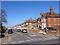
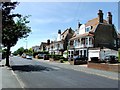
3
Gladstone Road (Broadstairs)
The southern end of the road.
Image: © Thomas Grant
Taken: 7 Jun 2007
0.11 miles
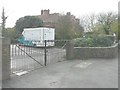
5
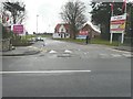
The entrance to Heresdon Place, Ramsgate Road
Planning permission has been granted by Thanet District Council under application number OL/TH/10/0307for an “outline application for the erection of 150 dwellings following the demolition of the existing school”. This was called Heresdon School. As the notice-board indicates, the houses are to be built by Abbey. This is how Image appeared at the start of January 2017.
Image: © John Baker
Taken: 9 Nov 2014
0.12 miles
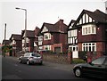
6
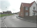
New houses under construction at Heresdon Place
Planning permission has been granted by Thanet District Council under application number OL/TH/10/0307 for an “outline application for the erection of 150 dwellings following the demolition of the existing school”. The school was Heresdon School. The houses are to be built by the developer Abbey and are located just off Ramsgate Road.
Image: © John Baker
Taken: 9 Nov 2014
0.12 miles
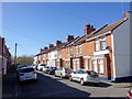
7
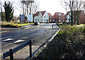
The entrance to Heresdon Place, Ramsgate Road
Compared with Image, more houses have been erected. As far as I could see, all building work on the other parts of the estate had been completed.
Image: © John Baker
Taken: 2 Jan 2017
0.12 miles
8
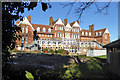
Yarrow Building, East Kent College
Not now part of the campus, but retained by the college as a hotel. A grade II listed building, built in 1895 as a convalescent home for children. This is a rear view.
Image: © Robin Webster
Taken: 29 Nov 2016
0.13 miles
10
East Kent College, Ramsgate Road
A more distant view of Image Planning permission has been granted by Thanet District Council under application number F/TH/14/0669 for the “change of use to training hotel (use class C1) together with erection of escape staircase, 1.8 metre high weld-mesh fencing and steel gates and insertion of window to rear and alteration to access road”.
Image: © John Baker
Taken: 9 Nov 2014
0.13 miles