IMAGES TAKEN NEAR TO
Kenwood Ridge, KENLEY, CR8 5JW
Introduction
This page details the photographs taken nearby to Kenwood Ridge, CR8 5JW by members of the Geograph project.
The Geograph project started in 2005 with the aim of publishing, organising and preserving representative images for every square kilometre of Great Britain, Ireland and the Isle of Man.

There are currently over 7.5m images from over14,400 individuals and you can help contribute to the project by visiting https://www.geograph.org.uk
Image Map
Images are licensed for reuse under creativecommons.org/licenses/by-sa/2.0
Notes
- Clicking on the map will re-center to the selected point.
- The higher the marker number, the further away the image location is from the centre of the postcode.
Image Listing (11 Images Found)
Images are licensed for reuse under creativecommons.org/licenses/by-sa/2.0
Image
Details
Distance
2
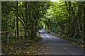
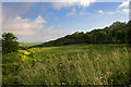
Old Lodge Lane
The wooded part of Old Lodge Lane.Caterham drive is at the bottom of the shot to the left.
Image: © Brett Oliver
Taken: 10 May 2007
0.16 miles
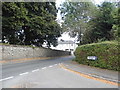
4
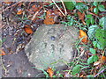
OS Benchmark
This OS rivet is set in a stone. It is located on a public footpath on the ground just after you leave Old Lodge Lane and cross over the stile.
Image: © dave-harris
Taken: 14 Oct 2018
0.18 miles
6
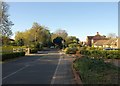
Hayes Lane
A long residential ridge-top road, here just north of its junction with Abbots Lane.
Image: © Derek Harper
Taken: 15 Oct 2011
0.20 miles
7
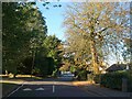
Hayes Lane
Taken further along the road shown in Image, beyond the speed limit signs.
Image: © Derek Harper
Taken: 15 Oct 2011
0.20 miles
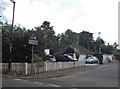
8
Frobisher Close at the junction of Hayes Lane
Image: © David Howard
Taken: 8 Jul 2018
0.21 miles
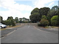
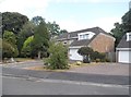
9
Betts Mead Kenley
Betts Mead Kenley looking towards Purley.
Image: © Brett Oliver
Taken: 20 Jun 2007
0.21 miles
10
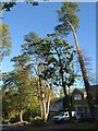
Abbots Lane, Kenley
Some tall pines and other trees along the south side of the residential road.
Image: © Derek Harper
Taken: 15 Oct 2011
0.22 miles