
IMAGES TAKEN NEAR TO
Downlands Road, PURLEY, CR8 4JF
Introduction
This page details the photographs taken nearby to Downlands Road, CR8 4JF by members of the Geograph project.
The Geograph project started in 2005 with the aim of publishing, organising and preserving representative images for every square kilometre of Great Britain, Ireland and the Isle of Man.

There are currently over 7.5m images from over14,400 individuals and you can help contribute to the project by visiting https://www.geograph.org.uk
Image Map
Images are licensed for reuse under creativecommons.org/licenses/by-sa/2.0
Notes
- Clicking on the map will re-center to the selected point.
- The higher the marker number, the further away the image location is from the centre of the postcode.
Image Listing (51 Images Found)
Images are licensed for reuse under creativecommons.org/licenses/by-sa/2.0
Image
Details
Distance
1
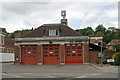
Purley fire station
Purley fire station, Brighton Road, Purley, London
Image: © Kevin Hale
Taken: 17 Jun 2007
0.06 miles
2
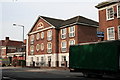
Andrews House, Brighton Road, Purley, Surrey
On the west side, just north of the Fire Station. An office block.
Image: © Dr Neil Clifton
Taken: 2 Aug 2007
0.06 miles
3
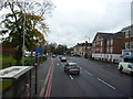
Reedham: Brighton Road
Looking south along the A23. Centre right in the distance is the former Coulsdon and Purley Town Hall, now used as office and residential accommodation. On the extreme right but out of picture is the formerly famous Orchid Ballroom, now converted to a fitness centre.
Image: © Dr Neil Clifton
Taken: 13 Nov 2014
0.06 miles
4
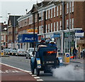
London - Brighton Veteran Car Run 2011
No.72, a Gardner-Serpollet, dating from 1900, seen on Brighton Road, Purley. Steam driven, the fire appears to have been well stoked!
Image: © Peter Trimming
Taken: 6 Nov 2011
0.06 miles
5
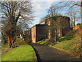
Purley, Surrey: St. Swithun's church
Image: © Dr Neil Clifton
Taken: 30 Nov 2011
0.07 miles
6
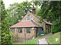
St Swithun's hall
The original St Swithun church, one of the "twenty-five" new churches of
Southwark Diocese in the inter-war years, dedicated in April 1929 by the Bishop of Southwark. It was replaced as a church in 1954 by Image on an adjacent site and remained in use as a hall; part of the original site was sold for housing in 2004 and the old hall was refurbished in 2006.
Image: © Stephen Craven
Taken: 26 Aug 2008
0.07 miles
7
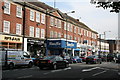
'Fitness First', Brighton Road, Purley
What now is a run-of-the-mill gymnasium is actually housed in a famous building, for this is, or rather was, the stylish Orchid Ballroom, Purley, very well known from the BBC 'Come Dancing' days. Always with a full 17-piece band, in its heyday it drew clients from all over the south of England.
Image: © Dr Neil Clifton
Taken: 2 Aug 2007
0.07 miles
8
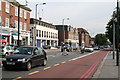
Brighton Road, Purley, Surrey (3)
Moving further north along Brighton Road and looking north we see the properties on the west side of the road. The white building is the Co-op funeral parlour. The furthest tall building on that side is the former UPLands telephone exchange. Grovelands Road joins at this point.
Image: © Dr Neil Clifton
Taken: 2 Aug 2007
0.07 miles
9
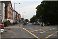
Brighton Road, Purley, Surrey (1)
Looking northwards from the Old Lodge Lane junction
Image: © Dr Neil Clifton
Taken: 2 Aug 2007
0.07 miles
10
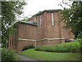
St Swithun's church, Purley
The church at the junction of Grovelands Road and Downlands Road, with its distinctive copper roof, occupies a steeply sloping site and is built on two levels. It was started in 1939 to the design of David E Nye and Partners but not completed until 1954 when it replaced the previous building Image just up the hill.
Image: © Stephen Craven
Taken: 26 Aug 2008
0.08 miles