
IMAGES TAKEN NEAR TO
Mersham Road, THORNTON HEATH, CR7 8NR
Introduction
This page details the photographs taken nearby to Mersham Road, CR7 8NR by members of the Geograph project.
The Geograph project started in 2005 with the aim of publishing, organising and preserving representative images for every square kilometre of Great Britain, Ireland and the Isle of Man.

There are currently over 7.5m images from over14,400 individuals and you can help contribute to the project by visiting https://www.geograph.org.uk
Image Map
Images are licensed for reuse under creativecommons.org/licenses/by-sa/2.0
Notes
- Clicking on the map will re-center to the selected point.
- The higher the marker number, the further away the image location is from the centre of the postcode.
Image Listing (74 Images Found)
Images are licensed for reuse under creativecommons.org/licenses/by-sa/2.0
Image
Details
Distance
3
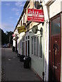
Converted shops, Grange Road
This little run of shops at the north end of Grangewood Park has been converted into flats, the shop windows filled in.
Image: © Christopher Hilton
Taken: 13 Sep 2011
0.03 miles
4
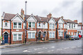
293 - 301 Grange Road
Row of houses on Grange Road, with name plaques Ferndale, Beechhurst, Oakhaven and Bankhurst. They are first marked on the 1913 25" map.
Image: © Ian Capper
Taken: 6 Jul 2024
0.03 miles
5
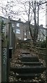
Backs of houses on Grange Road, Thornton Heath, from Mersham Road
Houses here are built on the side of the hill that descends from Upper Norwood to Thornton Heath: climbing up the sloping gardens brings one to flats that are at basement level relative to the fronts of the houses, on Grange Road.
Image: © Christopher Hilton
Taken: 7 Dec 2016
0.03 miles
6
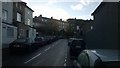
Mersham Road, Thornton Heath
High above the bend in the road are the backs of the converted shops on Grange Road seen in Image
Immediately to the left, to the left of the tree, are the backs of houses in Grangewood Terrace: their fronts are set some distance below the main Grange Road, an indication of how this area is set on the side of a steep hill.
In the middle distance, a public footpath sign pointing to the right marks the start of a path that runs along the backs of houses between Mersham Road and Livingstone Road: aligned as it is with a flight of steps down from Grange Road, it presumably perpetuates a right of way that predates the housing.
Image: © Christopher Hilton
Taken: 16 Nov 2016
0.03 miles
7
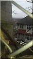
Grangewood Terrace and Mersham Road from Grange Road
Grangewood Terrace, seen here through a wire-mesh fence, is a terrace of inter-war houses set some way below Grange Road on the steeply sloping terrain that characterises this area, and accessed down a sloping path. The back gardens of the houses slope down to Mersham Road, seen heading into the distance between the houses. On the left of the picture is the side of a run of former shops that open onto Grange Road, now converted to flats; the lower levels of these are accessed via the back gardens off Mersham Road.
Image: © Christopher Hilton
Taken: 9 Feb 2017
0.04 miles
8
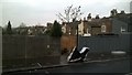
Public footpath between Mersham Road and Livingstone Road, Thornton Heath
This signposted public right of way runs between the backs of gardens on Mersham Road and Livingstone Road. It aligns with a flight of stairs down from Grange Road, crosses Hythe Road at Image and continues on the other side, and is formally designated as a public footpath: all these suggest that it perpetuates a public right of way that predates the houses around it.
Image: © Christopher Hilton
Taken: 7 Dec 2016
0.04 miles
9
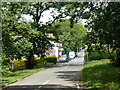
Way out of Grangewood Park
The park northern extremity in the vee of Wharncliffe Road and Grange Road.
Image: © Robin Webster
Taken: 1 Jul 2011
0.04 miles
10
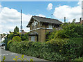
Lodge at entrance to Grangewood Park
The lodge predates the purchase of the property by the local council in 1900, and was the lodge for the main entrance to a private estate.
Image: © Robin Webster
Taken: 1 Jul 2011
0.04 miles