
IMAGES TAKEN NEAR TO
Norbury Avenue, THORNTON HEATH, CR7 8AN
Introduction
This page details the photographs taken nearby to Norbury Avenue, CR7 8AN by members of the Geograph project.
The Geograph project started in 2005 with the aim of publishing, organising and preserving representative images for every square kilometre of Great Britain, Ireland and the Isle of Man.

There are currently over 7.5m images from over14,400 individuals and you can help contribute to the project by visiting https://www.geograph.org.uk
Image Map
Images are licensed for reuse under creativecommons.org/licenses/by-sa/2.0
Notes
- Clicking on the map will re-center to the selected point.
- The higher the marker number, the further away the image location is from the centre of the postcode.
Image Listing (33 Images Found)
Images are licensed for reuse under creativecommons.org/licenses/by-sa/2.0
Image
Details
Distance
1
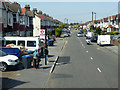
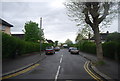
Melfort Road
By the Braemar Avenue bus stop towards Norbury.
Image: © Robin Webster
Taken: 19 Apr 2019
0.07 miles
2
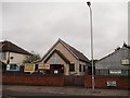
The Endeavour HQ, Thornton Heath
Scout Hut of the 67th South Croydon Scout Group, on the dividing point of Norbury Crescent and Melfort Road, opposite Strathyre Avenue.
Also used as a children's club and church group meeting place.
Image: © David Anstiss
Taken: 30 Oct 2011
0.09 miles
3
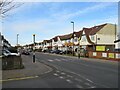
Norbury Crescent, Norbury
Norbury Crescent is a residential road in Norbury, in the suburbs of south London.
Image: © Malc McDonald
Taken: 19 Feb 2023
0.10 miles
4
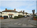
Camden Gardens, Norbury
Camden Gardens is a minor residential road in Norbury, in the suburbs of south London. The houses are semi-detached.
Image: © Malc McDonald
Taken: 19 Feb 2023
0.15 miles
6
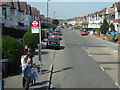
Melfort Road, Thornton Heath
By the Sandfield Road bus stop towards Norbury.
Image: © Robin Webster
Taken: 19 Apr 2019
0.18 miles
8
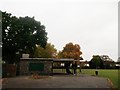
Thornton Heath Recreation Ground Pavilion
This sports pavilion is in the rectangular open-space area beside Norbury Brook.
Image: © David Anstiss
Taken: 30 Oct 2011
0.18 miles
9
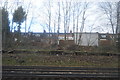
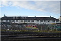
Houses on Melfort Rd seen from Sutton & Mole Valley Line
Image: © N Chadwick
Taken: 4 Feb 2018
0.18 miles
10
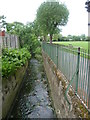
Norbury Brook alongside Thornton Heath Recreation Ground
Norbury Brook rises near Addiscombe and passes alongside Heavers Meadow at Selhurst before reaching this point. Further downstream it becomes the River Graveney and eventually flows into the River Wandle at Earlsfield - see http://www.geograph.ie/photo/2893879 Much of the Norbury Brook/River Graveney is in concrete culvert as seen here. Thornton Heath Recreation Ground was one of the earlier open spaces to be acquired by Croydon Council The first part was acquired in 1884 to serve built-up Thornton Heath, and a further part added in 1891. The footpath across the middle from Melfort Avenue to Bridport Road marks the divide between the two land acquisitions. There used to be a bandstand and in 1948 the park had to be closed for nine months to reinstate the grass as the park had been so well used.
Image: © Marathon
Taken: 6 Jun 2012
0.19 miles