
IMAGES TAKEN NEAR TO
Winifred Road, COULSDON, CR5 3JB
Introduction
This page details the photographs taken nearby to Winifred Road, CR5 3JB by members of the Geograph project.
The Geograph project started in 2005 with the aim of publishing, organising and preserving representative images for every square kilometre of Great Britain, Ireland and the Isle of Man.

There are currently over 7.5m images from over14,400 individuals and you can help contribute to the project by visiting https://www.geograph.org.uk
Image Map
Images are licensed for reuse under creativecommons.org/licenses/by-sa/2.0
Notes
- Clicking on the map will re-center to the selected point.
- The higher the marker number, the further away the image location is from the centre of the postcode.
Image Listing (30 Images Found)
Images are licensed for reuse under creativecommons.org/licenses/by-sa/2.0
Image
Details
Distance
1
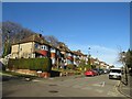
Winifred Road, Coulsdon
Winifred Road is a residential road in Coulsdon, in the outer suburbs of south London. The houses are built on a hillside, thus they stand at a higher level than the road.
Image: © Malc McDonald
Taken: 19 Feb 2023
0.04 miles
2
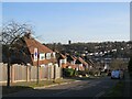
Alexander Road, Coulsdon
Alexander Road is a residential road on a hillside in Coulsdon, in the outer suburbs of south London.
This image was taken on a sunny February afternoon. At this time of year, the sun is low in the sky, resulting in long shadows.
Image: © Malc McDonald
Taken: 19 Feb 2023
0.05 miles
3
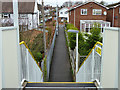
Path north from Woodmansterne station
Towards St Andrew's Road.
Image: © Robin Webster
Taken: 21 Nov 2010
0.15 miles
4
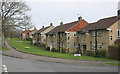
Houses in Beechwood Avenue, Coulsdon
I am not sure whether these houses form part of the Clock House estate or not.
Image: © David Kemp
Taken: 8 Apr 2015
0.15 miles
5
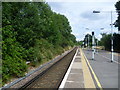
Woodmansterne station
A branch line along the Chipstead Valley from the Brighton Main Line was first projected in 1884. This scheme failed to take off. The line from Purley East Junction to Kingswood & Burgh Heath was eventually opened on 2nd November 1897 as a single track and this was doubled during 1899. The line finally reached Tattenham Corner on 4th June 1901 - Derby Day. Woodmansterne station did not open until 17th July 1932. This is the view looking along the single island platform in the direction of Purley and London.
Image: © Marathon
Taken: 14 Aug 2013
0.16 miles
6
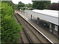
Woodmansterne station
Platform 1 - towards London.
Image: © Mike Quinn
Taken: 13 Aug 2008
0.17 miles
7
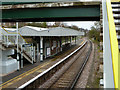
Woodmansterne station
Looking towards London.
Image: © Robin Webster
Taken: 21 Nov 2010
0.17 miles
8
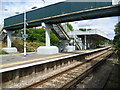
Woodmansterne station
A branch line along the Chipstead Valley from the Brighton Main Line was first projected in 1884. This scheme failed to take off. The line from Purley East Junction to Kingswood & Burgh Heath was eventually opened on 2nd November 1897 as a single track and this was doubled during 1899. The line finally reached Tattenham Corner on 4th June 1901 - Derby Day. Woodmansterne station did not open until 17th July 1932. This is the view looking across the down line to the single island platform.
Image: © Marathon
Taken: 14 Aug 2013
0.17 miles
9
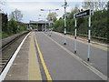
Woodmansterne railway station, Surrey
Opened in 1932 by the Southern Railway on the branch line from Purley to Tattenham Corner. View south west towards Chipstead and Tattenham Corner.
Image: © Nigel Thompson
Taken: 17 May 2012
0.17 miles
10
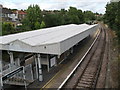
Woodmansterne station (2)
Platform 2 - for Tattenham Corner.
Image: © Mike Quinn
Taken: 13 Aug 2008
0.17 miles