IMAGES TAKEN NEAR TO
The Vale, COULSDON, CR5 2AU
Introduction
This page details the photographs taken nearby to The Vale, CR5 2AU by members of the Geograph project.
The Geograph project started in 2005 with the aim of publishing, organising and preserving representative images for every square kilometre of Great Britain, Ireland and the Isle of Man.

There are currently over 7.5m images from over14,400 individuals and you can help contribute to the project by visiting https://www.geograph.org.uk
Image Map
Images are licensed for reuse under creativecommons.org/licenses/by-sa/2.0
Notes
- Clicking on the map will re-center to the selected point.
- The higher the marker number, the further away the image location is from the centre of the postcode.
Image Listing (106 Images Found)
Images are licensed for reuse under creativecommons.org/licenses/by-sa/2.0
Image
Details
Distance
1
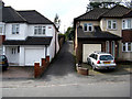
Coulsdon: Vale Close
This is a short cul-de-sac off the south side of Vale Road, between houses Nos 17 and 19.
Image: © Dr Neil Clifton
Taken: 24 Mar 2010
0.06 miles
2
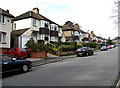
Coulsdon: The Vale
These are houses on the south side, numbered from 1 upwards (odds) even though they begin part-way along the road. Strangely, houses on the other side of the road here are numbered from 60 downwards (evens).
Image: © Dr Neil Clifton
Taken: 24 Mar 2010
0.07 miles
3
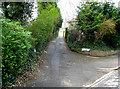
Coulsdon: Wellwood Close
This short and narrow cul-de-sac extends southwards from The Vale to serve one or two properties built by infill behind the other houses.
Image: © Dr Neil Clifton
Taken: 24 Mar 2010
0.09 miles
4
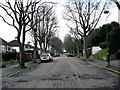
Coulsdon: The Drive
Looking southwest from outside No.6. This is a very pleasant and quiet tree-lined road, but the road surface looks as if it could do with some attention.
Image: © Dr Neil Clifton
Taken: 24 Mar 2010
0.11 miles
5
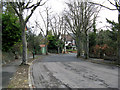
Coulsdon: The Drive
Looking east, this is taken from opposite No 6. The mock-tudor house is the distance is No 2. These are large houses with plenty of space around them, but there has been some infilling.
Image: © Dr Neil Clifton
Taken: 24 Mar 2010
0.15 miles
6
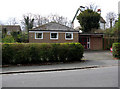
Coulsdon: The Vale Gospel Hall
This small church, if such it can be called, is on the south side of The Vale. It is about the size of a bungalow, and may have been converted from one. I am not clear to which branch of the Christian Church it is related. A somewhat uncertain notice appears outside, to say that the Gospel is preached here on 'most' Sundays at 6.30 p.m.
Image: © Dr Neil Clifton
Taken: 24 Mar 2010
0.15 miles
7
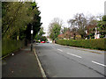
Coulsdon: The Vale
Looking west from its junction with Smitham Downs Road. From here, The Vale runs to another T-junction with Woodcote Grove Road.
Image: © Dr Neil Clifton
Taken: 24 Mar 2010
0.15 miles
8

Woodcote Grove Road, Coulsdon
Looking north on a stretch of the A237 towards Wallington.
Image: © Stephen Richards
Taken: Unknown
0.15 miles
9
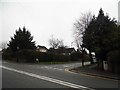
Woodcote Grove Road, Coulsdon
Looking towards Grove Wood Hill
Image: © David Howard
Taken: 24 Jan 2016
0.17 miles