
IMAGES TAKEN NEAR TO
Bradmore Way, COULSDON, CR5 1PB
Introduction
This page details the photographs taken nearby to Bradmore Way, CR5 1PB by members of the Geograph project.
The Geograph project started in 2005 with the aim of publishing, organising and preserving representative images for every square kilometre of Great Britain, Ireland and the Isle of Man.

There are currently over 7.5m images from over14,400 individuals and you can help contribute to the project by visiting https://www.geograph.org.uk
Image Map
Images are licensed for reuse under creativecommons.org/licenses/by-sa/2.0
Notes
- Clicking on the map will re-center to the selected point.
- The higher the marker number, the further away the image location is from the centre of the postcode.
Image Listing (35 Images Found)
Images are licensed for reuse under creativecommons.org/licenses/by-sa/2.0
Image
Details
Distance
1
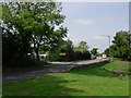
Territorial Army recruitment entrance in Marlpit Lane - Old Coulsdon
German prisoners of war were housed in the barracks in the 1940s on the left on Marlpit Lane (opposite the village pond). The prisoners were used to build prefabs nearby.
Image: © Jean Barrow
Taken: 6 Sep 2006
0.06 miles
2
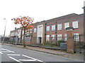
The Territorial Army centre on Marlpit Lane
Image: © David Howard
Taken: 17 Nov 2013
0.09 miles
3
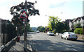
Marlpit Lane - Steep Hill 10%
Marlpit Lane, Coulsdon. 10% steep hill down sign.
Image: © Adam Morse
Taken: 11 Jun 2009
0.10 miles
4
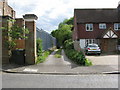
Old Coulsdon: Footpath off Marlpit Lane
This footpath at the side of the TA Centre gives access through to Bradmore Way
Image: © Dr Neil Clifton
Taken: 12 May 2011
0.10 miles
5
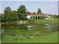
Bradmore Green Pond - Old Coulsdon - Surrey
This pond is at the junction of the B276 Marlpit Lane and B2030 Coulsdon Road.
Image: © Jean Barrow
Taken: 6 Sep 2006
0.10 miles
6
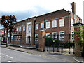
Old Coulsdon: Territorial Army Centre
This building started life in the 1930s as Purley High School for Girls.
Image: © Dr Neil Clifton
Taken: 12 May 2011
0.11 miles
7
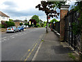
Coulsdon: Marlpit Lane
Looking uphill (southeast) from outside the TA centre, whose fence is seen on the right. The bus stops visible only have one bus and hour, and that only on Mondays to Saturdays day time. This is just a local route, No 404.
Image: © Dr Neil Clifton
Taken: 12 May 2011
0.13 miles
8
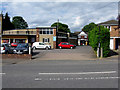
Old Coulsdon: Robe and Hitchen's
Services for the motorist
Image: © Dr Neil Clifton
Taken: 12 May 2011
0.13 miles
9
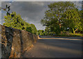
Marlpit Lane
By the duck pond, looking SE towards the junction with Coulsdon Road
Image: © Kurseong Carl
Taken: 27 May 2011
0.13 miles
10
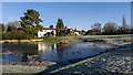
Bradmore Green pond, Old Coulsdon
Old Coulsdon pond on a winter's day
Image: © P Redz
Taken: 17 Jan 2013
0.14 miles