IMAGES TAKEN NEAR TO
Benedict Wharf, Benedict Road, MITCHAM, CR4 3BT
Introduction
This page details the photographs taken nearby to Benedict Wharf, Benedict Road, CR4 3BT by members of the Geograph project.
The Geograph project started in 2005 with the aim of publishing, organising and preserving representative images for every square kilometre of Great Britain, Ireland and the Isle of Man.

There are currently over 7.5m images from over14,400 individuals and you can help contribute to the project by visiting https://www.geograph.org.uk
Image Map
Images are licensed for reuse under creativecommons.org/licenses/by-sa/2.0
Notes
- Clicking on the map will re-center to the selected point.
- The higher the marker number, the further away the image location is from the centre of the postcode.
Image Listing (68 Images Found)
Images are licensed for reuse under creativecommons.org/licenses/by-sa/2.0
Image
Details
Distance

2
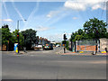
Mitcham: Morden Road
Seen from its junction with London Road
Image: © Dr Neil Clifton
Taken: 24 May 2011
0.10 miles
3
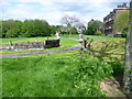
London Road Playing Fields
Maps from the start of the 20th century show a number of houses along London Road with large gardens stretching back into what is now this park. The largest of these was Baron House, named after Oliver Baron JP, an 18th century barrister. During the 1920s, much of the site became a large gravel pit. Subsequently the pit filled with water and was then reinstated with such items as old buses and trams, before being levelled in the 1930s for playing fields. In the mid 1980s, a campaign was started to preserve the area as a park and it was formally opened as London Road Playing Fields in April 1992. The flats on the right are in London Road.
Image: © Marathon
Taken: 16 May 2012
0.10 miles
4
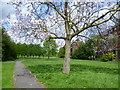
London Road Playing Fields
Maps from the start of the 20th century show a number of houses along London Road with large gardens stretching back into what is now this park. The largest of these was Baron House, named after Oliver Baron JP, an 18th century barrister. During the 1920s, much of the site became a large gravel pit. Subsequently the pit filled with water and was then reinstated with such items as old buses and trams, before being levelled in the 1930s for playing fields. In the mid 1980s, a campaign was started to preserve the area as a park and it was formally opened as London Road Playing Fields in April 1992. The flats on the right are in London Road.
Image: © Marathon
Taken: 16 May 2012
0.10 miles
5
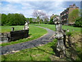
London Road Playing Fields, Mitcham
Maps from the start of the 20th century show a number of houses along London Road with large gardens stretching back into what is now this park. The largest of these was Baron House, named after Oliver Baron JP, an 18th century barrister. During the 1920s, much of the site became a large gravel pit. Subsequently the pit filled with water and was then reinstated with such items as old buses and trams, before being levelled in the 1930s for playing fields. In the mid 1980s, a campaign was started to preserve the area as a park and it was formally opened as London Road Playing Fields in April 1992. The flats on the right are in London Road.
Image: © Marathon
Taken: 16 May 2012
0.10 miles
6
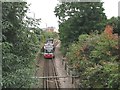
Tram approaching Mitcham
The bridge under London Road was only wide enough for one track with its overhead line.
Image: © Stephen Craven
Taken: 26 Aug 2008
0.12 miles
7
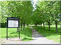
Entrance to London Road Playing Fields
Maps from the start of the 20th century show a number of houses along London Road with large gardens stretching back into what is now this park. The largest of these was Baron House, named after Oliver Baron JP, an 18th century barrister. During the 1920s, much of the site became a large gravel pit. Subsequently the pit filled with water and was then reinstated with such items as old buses and trams, before being levelled in the 1930s for playing fields. In the mid 1980s, a campaign was started to preserve the area as a park and it was formally opened as London Road Playing Fields in April 1992. This is the entrance from London Road.
Image: © Marathon
Taken: 16 May 2012
0.12 miles
8
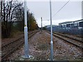
Croydon Tramlink
Looking towards Croydon taken from Belgrave Walk tram stop.
Image: © Phillip Perry
Taken: 17 Nov 2008
0.13 miles
9
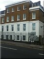
Church of Jesus Christ of Latter-Day Saints
Image: © Paul Barnett
Taken: 18 Apr 2014
0.13 miles