
IMAGES TAKEN NEAR TO
High Drive, CATERHAM, CR3 7EL
Introduction
This page details the photographs taken nearby to High Drive, CR3 7EL by members of the Geograph project.
The Geograph project started in 2005 with the aim of publishing, organising and preserving representative images for every square kilometre of Great Britain, Ireland and the Isle of Man.

There are currently over 7.5m images from over14,400 individuals and you can help contribute to the project by visiting https://www.geograph.org.uk
Image Map
Images are licensed for reuse under creativecommons.org/licenses/by-sa/2.0
Notes
- Clicking on the map will re-center to the selected point.
- The higher the marker number, the further away the image location is from the centre of the postcode.
Image Listing (43 Images Found)
Images are licensed for reuse under creativecommons.org/licenses/by-sa/2.0
Image
Details
Distance
1
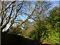
Long Hill, Woldingham
There is a notice near this point saying "Private street, Unmade single track ahead, Unsuitable for motor vehicles." This is just past the primary school.
Ian Nairn in 'The Buildings of England: Surrey' describes Woldingham: "This tiny downland hamlet SE of Caterham has gradually become a very leafy suburb. The parish is full of steep-sided valleys and the houses are hidden away in these, usually drowned in trees - an object lesson to the brutally expanded Warlingham, next door."
Image: © Marathon
Taken: 2 Mar 2023
0.09 miles
3
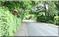
Station Road - Steep Hill 8%
Station Road, Woldingham. 8% steep hill down sign.
Image: © Adam Morse
Taken: 11 Jun 2009
0.16 miles
6
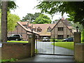
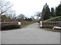
Woldingham: The Grange, Southdown Road
Image: © Dr Neil Clifton
Taken: 3 Jul 2012
0.17 miles
7
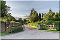
High Drive
Entrance off Croft Road to High Drive, a private road in Woldingham.
Image: © Ian Capper
Taken: 5 Jun 2014
0.17 miles
8
Croft Road, Woldingham
Ian Nairn in 'The Buildings of England: Surrey' describes Woldingham: "This tiny downland hamlet SE of Caterham has gradually become a very leafy suburb. The parish is full of steep-sided valleys and the houses are hidden away in these, usually drowned in trees - an object lesson to the brutally expanded Warlingham, next door."
This is Croft Road near St Paul's Church.
Image: © Marathon
Taken: 2 Mar 2023
0.17 miles
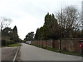
10
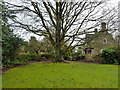
Churchyard tree, Woldingham
In the corner of the churchyard which dates from 1933 and has no burials.
Image: © Robin Webster
Taken: 3 Feb 2011
0.19 miles