
IMAGES TAKEN NEAR TO
Alderwood Close, CATERHAM, CR3 6AT
Introduction
This page details the photographs taken nearby to Alderwood Close, CR3 6AT by members of the Geograph project.
The Geograph project started in 2005 with the aim of publishing, organising and preserving representative images for every square kilometre of Great Britain, Ireland and the Isle of Man.

There are currently over 7.5m images from over14,400 individuals and you can help contribute to the project by visiting https://www.geograph.org.uk
Image Map
Images are licensed for reuse under creativecommons.org/licenses/by-sa/2.0
Notes
- Clicking on the map will re-center to the selected point.
- The higher the marker number, the further away the image location is from the centre of the postcode.
Image Listing (12 Images Found)
Images are licensed for reuse under creativecommons.org/licenses/by-sa/2.0
Image
Details
Distance
1
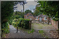
Harestone Lane
Road linking Stanstead Road with Harestone Valley Road. The northern and southern ends are tarmaced, while the central section, part of which is seen here, is an unmade up bridleway.
Image: © Ian Capper
Taken: 12 Oct 2018
0.06 miles
2

Oak, Stanstead Road, Caterham
This tree, a sort of Turkey oak, has some attractive red autumn leaves. This is by Newbery Close.
Image: © Derek Harper
Taken: 15 Oct 2011
0.08 miles
3
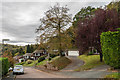
Dunedin Drive
c1970s housing in a road off Underwood Road, below Harestone Lane. Dunedin was the name of a Victorian house in Underwood Road which used to stand at what is now the junction of the two roads.
Image: © Ian Capper
Taken: 12 Oct 2018
0.10 miles
4
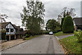
Harestone Lane
Housing in the northern section of Harestone Lane.
Image: © Ian Capper
Taken: 12 Oct 2018
0.12 miles
5
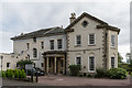
Woodside View
Nursing home in High View, off Harestone Lane. The building was built in 1861 and was originally called Woodlands.
Image: © Ian Capper
Taken: 12 Oct 2018
0.18 miles
6

Stanstead Road, Caterham
A leafy suburban road heading for the centre of Caterham.
Image: © Derek Harper
Taken: 15 Oct 2011
0.20 miles
7
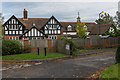
100 Harestone Lane and 1 High View
Lodge and stables/carriage house to Woodside View (originally Woodlands - see Image), dating from 1861.
Image: © Ian Capper
Taken: 12 Oct 2018
0.20 miles
8
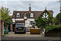
1 High View
Stables/carriage house to Woodside View (originally Woodlands - see Image), dating from 1861.
Image: © Ian Capper
Taken: 12 Oct 2018
0.20 miles
9
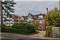
36 - 38 Stanstead Road
1895-built house in Stanstead Road, named on old maps as Glen Eden.
Image: © Ian Capper
Taken: 12 Oct 2018
0.21 miles
10
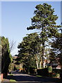
Caterham
Harestone Valley Road. There are some magnificent pine trees along this road.
Image: © Peter Trimming
Taken: 17 Nov 2017
0.23 miles