
IMAGES TAKEN NEAR TO
High Street, CATERHAM, CR3 5UX
Introduction
This page details the photographs taken nearby to High Street, CR3 5UX by members of the Geograph project.
The Geograph project started in 2005 with the aim of publishing, organising and preserving representative images for every square kilometre of Great Britain, Ireland and the Isle of Man.

There are currently over 7.5m images from over14,400 individuals and you can help contribute to the project by visiting https://www.geograph.org.uk
Image Map
Images are licensed for reuse under creativecommons.org/licenses/by-sa/2.0
Notes
- Clicking on the map will re-center to the selected point.
- The higher the marker number, the further away the image location is from the centre of the postcode.
Image Listing (146 Images Found)
Images are licensed for reuse under creativecommons.org/licenses/by-sa/2.0
Image
Details
Distance
2
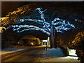
Christmas tradition, Caterham-on-the -Hill
Annual display on the Cedar.
Image: © Sally
Taken: 18 Dec 2010
0.02 miles
3
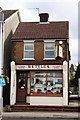
Bettles, Caterham-on-the-Hill, Surrey
Located on High Street, opposite Court Road. A traditional footwear repair shop; not so common, in this part of England, nowadays.
Image: © Peter Trimming
Taken: 1 Apr 2010
0.02 miles
4
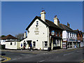
Caterham: The 'Royal Oak'
At the junction of Court Road with High Street
Image: © Dr Neil Clifton
Taken: 21 Apr 2011
0.02 miles
5
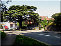
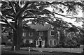
Caterham: Cedar Tree
This very large tree originally formed part of the rectory gardens. Experts say it is only some 200-250 years old.
Image: © Dr Neil Clifton
Taken: 21 Apr 2011
0.03 miles
6
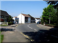
Caterham: High Street
Looking north from very near its southern end. On the left is a small cul-de-sac of houses which are included in the High Street numbering.
Image: © Dr Neil Clifton
Taken: 21 Apr 2011
0.03 miles
7
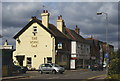
The Royal Oak, Caterham-on-the-Hill, Surrey
Located at the junction of Court Road and Hill Street. Spring sunshine, and dark clouds; luckily, no rain followed.
Image: © Peter Trimming
Taken: 1 Apr 2010
0.03 miles
8
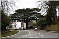
High Street, Caterham-on-the-Hill, Surrey
Only just up the road from Caterham; this area has a different feel, and its own High Street and shops. High Street runs to the north, from this point.
Image: © Peter Trimming
Taken: 1 Apr 2010
0.03 miles
9
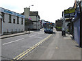
Caterham: High Street, looking south, with bus
The bus is working for Metrobus on Route 409, from East Grinstead to West Croydon. This route has a long and interesting history. It began in the 1920s as an East Surrey route, numbered 9, and running from West Croydon to Uckfield. On takeover by London Transport in 1933, it was renumbered S9, as all Southern area services were prefixed S. Then when 400 was added to all Southern area routes, it became 409. During WW2, the southern terminus was cut back to Forest Row, where it remained for very many years. For all of this time, its route between Caterham and Croydon was via Stoats Nest Road and Purley. About 1965, the route received the RML (long Routemaster) class of buses and retained these until the 1980s brought one-man operation. About 1998 the route between Caterham and Croydon was altered to be via Selsdon, and the southern terminus was cut back further to East Grinstead, the old Caterham to Croydon part becoming self-contained with red buses.
Image: © Dr Neil Clifton
Taken: 28 Apr 2011
0.04 miles
10
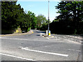
Caterham: Whyteleafe Road
Looking north from its southern end at the top of Church Hill. This road is popular with northbound motorists anxious to avoid the High Street.
Image: © Dr Neil Clifton
Taken: 21 Apr 2011
0.07 miles