Caterham: High Street, looking south, with bus
Introduction
The photograph on this page of Caterham: High Street, looking south, with bus by Dr Neil Clifton as part of the Geograph project.
The Geograph project started in 2005 with the aim of publishing, organising and preserving representative images for every square kilometre of Great Britain, Ireland and the Isle of Man.

There are currently over 7.5m images from over 14,400 individuals and you can help contribute to the project by visiting https://www.geograph.org.uk
Caterham: High Street, looking south, with bus
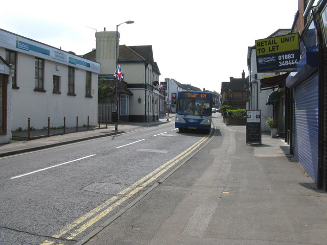
Image: © Dr Neil Clifton Taken: 28 Apr 2011
The bus is working for Metrobus on Route 409, from East Grinstead to West Croydon. This route has a long and interesting history. It began in the 1920s as an East Surrey route, numbered 9, and running from West Croydon to Uckfield. On takeover by London Transport in 1933, it was renumbered S9, as all Southern area services were prefixed S. Then when 400 was added to all Southern area routes, it became 409. During WW2, the southern terminus was cut back to Forest Row, where it remained for very many years. For all of this time, its route between Caterham and Croydon was via Stoats Nest Road and Purley. About 1965, the route received the RML (long Routemaster) class of buses and retained these until the 1980s brought one-man operation. About 1998 the route between Caterham and Croydon was altered to be via Selsdon, and the southern terminus was cut back further to East Grinstead, the old Caterham to Croydon part becoming self-contained with red buses.
Images are licensed for reuse under creativecommons.org/licenses/by-sa/2.0
Image Location
Latitude
51.284908
Longitude
-0.088087