
IMAGES TAKEN NEAR TO
Milton Road, CATERHAM, CR3 5JD
Introduction
This page details the photographs taken nearby to Milton Road, CR3 5JD by members of the Geograph project.
The Geograph project started in 2005 with the aim of publishing, organising and preserving representative images for every square kilometre of Great Britain, Ireland and the Isle of Man.

There are currently over 7.5m images from over14,400 individuals and you can help contribute to the project by visiting https://www.geograph.org.uk
Image Map
Images are licensed for reuse under creativecommons.org/licenses/by-sa/2.0
Notes
- Clicking on the map will re-center to the selected point.
- The higher the marker number, the further away the image location is from the centre of the postcode.
Image Listing (50 Images Found)
Images are licensed for reuse under creativecommons.org/licenses/by-sa/2.0
Image
Details
Distance
1
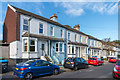
Cromwell Road
Turn of the 19th/20th Century terrace of villas on Cromwell Road. A plaque in the centre of the row gives the name "Ada Villas". The embellishments around the ground floor windows and doors suggest that they were built with a slightly more upmarket feel compared with the terrace beyond (see Image).
Image: © Ian Capper
Taken: 27 Oct 2018
0.06 miles
2
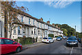
Cromwell Road
Turn of the 19th/20th Century terrace on Cromwell Road. Compare its immediate neighbours (see Image) - this terrace is plainer in design.
Image: © Ian Capper
Taken: 27 Oct 2018
0.08 miles
4
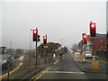
Coulsdon Road in the rain
Banstead Road goes off to the left. It was misty as well as drizzling, and Caterham is on the North Downs so gets the mist first.
Image: © David Howard
Taken: 17 Nov 2013
0.11 miles
5
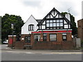
The 'Tally Ho', Caterham on the Hill
This pub is still open, but the exterior does not bear much evidence of tlc.
Image: © Dr Neil Clifton
Taken: 10 Jun 2009
0.12 miles
6
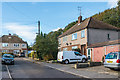
Cromwell Grove
c1950s housing on a cul-de-sac off Cromwell Road, backing onto the border of Surrey and the London Borough of Croydon. The trees in the right background are on Coulsdon Common.
Image: © Ian Capper
Taken: 27 Oct 2018
0.13 miles
7
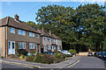
Cromwell Road
c1950s housing on a cul-de-sac ending at the border of Surrey and the London Borough of Croydon. The trees in the background are on Coulsdon Common. Cromwell Road started development around the end of the 19th Century, but this section is much later, being built on the site of the former Ninehams House.
Image: © Ian Capper
Taken: 27 Oct 2018
0.13 miles
8
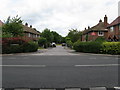
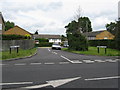
Thomas Avenue, Caterham
The 'Private No Access' notice displayed in the garden of the house on the right is of no legal validity. Thomas Avenue is a public road like any other in Caterham.
Image: © Dr Neil Clifton
Taken: 10 Jun 2009
0.13 miles
9
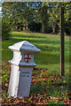
Coal tax post no 168
This coal tax post (no 168 on the list linked to below) is situated alongside Stites Hill Road as it enters Coulsdon Common. See Image for a wider view.
Image: © Ian Capper
Taken: 27 Oct 2018
0.14 miles
10
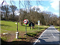
First Signs of London
This is leaving Surrey and coming into London, although it doesn't look like it.
This is Coulsdon Common, an amenity area of countryside maintained by the City of London. That's their smart black sign. The houses begin just round the corner.
The little bollard nearest the camera is a Coal Tax Post. There's another one about 5 minutes walk up the path on the left. I know because I've just put in a picture of it.
Funny, you can go your whole life without ever meeting a Coal Tax Post and then two come along at once. I've even got the Wiki. link still saved http://en.wikipedia.org/wiki/Coal-tax_post
Image: © Des Blenkinsopp
Taken: 2 Apr 2013
0.14 miles