
IMAGES TAKEN NEAR TO
Leazes Avenue, CATERHAM, CR3 5AG
Introduction
This page details the photographs taken nearby to Leazes Avenue, CR3 5AG by members of the Geograph project.
The Geograph project started in 2005 with the aim of publishing, organising and preserving representative images for every square kilometre of Great Britain, Ireland and the Isle of Man.

There are currently over 7.5m images from over14,400 individuals and you can help contribute to the project by visiting https://www.geograph.org.uk
Image Map
Images are licensed for reuse under creativecommons.org/licenses/by-sa/2.0
Notes
- Clicking on the map will re-center to the selected point.
- The higher the marker number, the further away the image location is from the centre of the postcode.
Image Listing (10 Images Found)
Images are licensed for reuse under creativecommons.org/licenses/by-sa/2.0
Image
Details
Distance
1
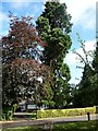
Little and Large, Chaldon
I was struck by the enormous discrepancy between the size of the bungalow and the size of the tree. Fellow Geographers 4wd and Andy Waddington have suggested that it is a Redwood Sequoia (Sequoiadendron giganteum). As I walked on, I realised the lane comprised a line of similar bungalows, each with an enormous tree looming over it. Perhaps once it was a grand avenue to a grand house set in rolling parkland (now the obligatory golf course).
Image: © Stephen Richards
Taken: Unknown
0.02 miles
2
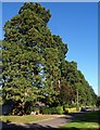
Redwoods, The Leazes, Chaldon
A view down the remarkable row of trees lining Leazes Avenue; see Image
Image: © Derek Harper
Taken: 15 Oct 2011
0.03 miles
3
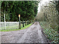
The Bridlepath, a private road
But a public bridleway, Chaldon 78.
Image: © Robin Webster
Taken: 24 Jan 2011
0.13 miles
4
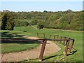
Surrey National Golf Club
A view down the western valley of the course, towards its junction with Happy Valley.
Image: © Derek Harper
Taken: 15 Oct 2011
0.14 miles
5
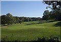
Green, Surrey National Golf Club
The green for hole 11, a tricky par 4, seen from bridleway 77, close to the western edge of its crossing of the course.
Image: © Derek Harper
Taken: 15 Oct 2011
0.15 miles
6
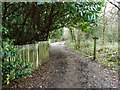
Crossing the border
The bridleway south from Happy Valley leaves the Greater London area - Croydon Borough - and enters Chaldon, Tandridge District, Surrey. Immediately houses start to appear in the woods on the right. One would think it would be the other way around!
Image: © Robin Webster
Taken: 24 Jan 2011
0.16 miles
7
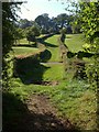
Bridleway across Surrey National Golf Club
Running along a wide grassy track between hedges, bridleway 77 crosses the western of the two valleys occupied by the golf course.
Image: © Derek Harper
Taken: 15 Oct 2011
0.18 miles
8
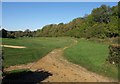
Track, Surrey National Golf Club
This looks to the right along the track you can see crossing bridleway 77 a little way ahead in Image The track is descending the western of the two arms of Happy Valley.
Image: © Derek Harper
Taken: 15 Oct 2011
0.21 miles
9
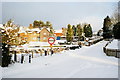
Doctors Lane, Chaldon, Surrey
Looking up Doctors Lane, from the junction with Church Lane.
Image: © Peter Trimming
Taken: 7 Jan 2010
0.21 miles
10

Rape Field
In a field by Chaldon Church May 2012
Image: © Kurseong Carl
Taken: 11 May 2012
0.24 miles