
IMAGES TAKEN NEAR TO
Beverley Road, WHYTELEAFE, CR3 0DX
Introduction
This page details the photographs taken nearby to Beverley Road, CR3 0DX by members of the Geograph project.
The Geograph project started in 2005 with the aim of publishing, organising and preserving representative images for every square kilometre of Great Britain, Ireland and the Isle of Man.

There are currently over 7.5m images from over14,400 individuals and you can help contribute to the project by visiting https://www.geograph.org.uk
Image Map
Images are licensed for reuse under creativecommons.org/licenses/by-sa/2.0
Notes
- Clicking on the map will re-center to the selected point.
- The higher the marker number, the further away the image location is from the centre of the postcode.
Image Listing (34 Images Found)
Images are licensed for reuse under creativecommons.org/licenses/by-sa/2.0
Image
Details
Distance
1
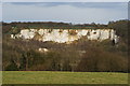
View Towards Riddlesdown Quarry, Surrey
Riddlesdown Quarry; formerly known as Rose & Crown Pit, after the pub which used to stand opposite the entrance, is the chalk cliff in the centre of picture. Photographed from the edge of Kenley Common, before it drops sharply into the valley which carries the A22 road, between Purley and Caterham.
Image: © Peter Trimming
Taken: 1 Apr 2010
0.07 miles
2
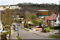
New Barn Lane, Whyteleafe, Surrey
Looking down to road, towards the gasometer! Without this, and the scar of Riddlesdown Quarry, it would be quite an attractive location.
Image: © Peter Trimming
Taken: 1 Apr 2010
0.09 miles
3
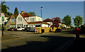
Crossroads, Beverley Road
Beverley Road crosses Hillcrest Road. Are we in Kenley or Whyteleafe here?
Image: © Derek Harper
Taken: 26 Apr 2022
0.09 miles
4
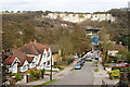
New Barn Lane, Whyteleafe, Surrey
Looking down the road, in the direction of Riddlesdown Quarry. Two railway lines are just visible; near the centre of picture, a footbridge can be seen crossing the line from Purley to Caterham. Beyond the footbridge, and building work on the site of the former Rose & Crown pub, part of the Riddlesdown viaduct can be seen. The viaduct carries the railway line which runs from East Croydon to Oxted.
Image: © Peter Trimming
Taken: 1 Apr 2010
0.10 miles
5
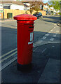
Postbox, Beverley Road
George V priority postbox CR3 338 can be glimpsed lurking in the shadows in Image
Image: © Derek Harper
Taken: 26 Apr 2022
0.11 miles
6
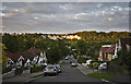
New Barn Lane Kenley
New Barn Lane Kenley looking towards the chalk pit on Riddlesdown.
Image: © Brett Oliver
Taken: 24 Aug 2008
0.11 miles
7
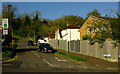
New Barn Lane, Kenley
The London Loop follows this road; you can make out the signpost where it follows footpath 31 towards Kenley Common. View from the crossroads with Beverley Road.
Image: © Derek Harper
Taken: 26 Apr 2022
0.11 miles
8
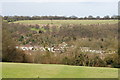
View Towards Riddlesdown, Surrey
Photograph taken from Kenley Common. The houses, in the valley below, line the A22 road between Purley and Caterham. The common, at Riddlesdown, can be seen on the opposite side of the valley.
Image: © Peter Trimming
Taken: 1 Apr 2010
0.11 miles
9
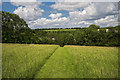
New Barn Lane Footpath Kenley
New Barn Lane Footpath over Kenley Common.
Image: © Brett Oliver
Taken: 31 May 2007
0.12 miles
10
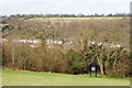
The Edge of Kenley Common, Surrey
The lady, and dog, have just negotiated the steep climb up from the valley bottom. Steps have been cut into the chalk, and a handrail added, to ease the passage in wet weather.
Image: © Peter Trimming
Taken: 1 Apr 2010
0.12 miles