IMAGES TAKEN NEAR TO
York Road, SOUTH CROYDON, CR2 8NQ
Introduction
This page details the photographs taken nearby to York Road, CR2 8NQ by members of the Geograph project.
The Geograph project started in 2005 with the aim of publishing, organising and preserving representative images for every square kilometre of Great Britain, Ireland and the Isle of Man.

There are currently over 7.5m images from over14,400 individuals and you can help contribute to the project by visiting https://www.geograph.org.uk
Image Map (Loading...)


Getting Data...Please wait
Leaflet Map data © OpenStreetMap
Images are licensed for reuse under creativecommons.org/licenses/by-sa/2.0
Notes
- Clicking on the map will re-center to the selected point.
- The higher the marker number, the further away the image location is from the centre of the postcode.
Image Listing (10 Images Found)
Images are licensed for reuse under creativecommons.org/licenses/by-sa/2.0
Image
Details
Distance
1
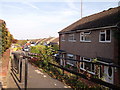
Path to Osprey Gardens
Leading from Kingfisher Gardens.
Image: © David Anstiss
Taken: 23 Oct 2011
0.18 miles
2
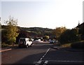
Kingfisher Gardens, Forestdale
This road leads down towards various housing streets.
In the background is Selsdon Wood.
Image: © David Anstiss
Taken: 23 Oct 2011
0.19 miles
3
Path by Ashen Vale
Path heading to Selsdon Park Road by Ashen Vale
Image: © Shaun Ferguson
Taken: 26 Jun 2012
0.20 miles
4

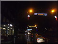
Jesus Christ of Latter Day Saints
Mormon church on Selsdon Park Road.
Image: © Des Blenkinsopp
Taken: 1 Aug 2013
0.21 miles
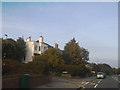
5
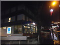
Aldi on Addington Road, Selsdon
It looks more like a police station to me, maybe it was. Selsdon had a station till the 1970s but now it's got a tram stop about a mile away built a couple of decades later.
Image: © David Howard
Taken: 1 Jan 2017
0.22 miles
7
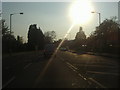
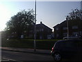
Selsdon Park Road
Heading west into the sun
Image: © David Howard
Taken: 18 Apr 2011
0.23 miles
8
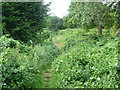
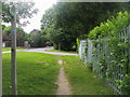
Two long distance footpaths are here
This rather inconsequential footpath to the north of Addington Road and leading up to Littleheath Woods is followed by both the London LOOP and the Vanguard Way. The former is a 152 mile circle around London, largely through the Green Belt, while the latter is a 66 mile route from East Croydon to Newhaven.
Image: © Marathon
Taken: 12 Sep 2012
0.23 miles