IMAGES TAKEN NEAR TO
Normanton Road, SOUTH CROYDON, CR2 7FR
Introduction
This page details the photographs taken nearby to Normanton Road, CR2 7FR by members of the Geograph project.
The Geograph project started in 2005 with the aim of publishing, organising and preserving representative images for every square kilometre of Great Britain, Ireland and the Isle of Man.

There are currently over 7.5m images from over14,400 individuals and you can help contribute to the project by visiting https://www.geograph.org.uk
Image Map
Images are licensed for reuse under creativecommons.org/licenses/by-sa/2.0
Notes
- Clicking on the map will re-center to the selected point.
- The higher the marker number, the further away the image location is from the centre of the postcode.
Image Listing (51 Images Found)
Images are licensed for reuse under creativecommons.org/licenses/by-sa/2.0
Image
Details
Distance
1
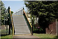
South Croydon
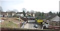
Footbridge across the overgrown trackbed of the former Woodside and South Croydon Joint Railway (opened 1885, closed 1983).
Image: © Peter Trimming
Taken: 19 Apr 2020
0.08 miles
2
South Croydon
The overgrown trackbed of the former Woodside and South Croydon Joint Railway (opened 1885, closed 1983), looking away from the location of the Selsdon Road station.
Image: © Peter Trimming
Taken: 19 Apr 2020
0.09 miles
3
South Croydon
The overgrown trackbed of the former Woodside and South Croydon Joint Railway (opened 1885, closed 1983), looking towards the location of the Selsdon Road station.
Image: © Peter Trimming
Taken: 19 Apr 2020
0.09 miles
5
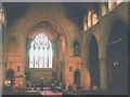
Interior of Emmanuel church
Emmanuel (Anglican) parish church on Normanton Road. It was built in 1899 to the designs of architect T. Roger Smith.
Image: © Stephen Craven
Taken: 18 Sep 2003
0.14 miles
7
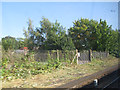
Site of Selsdon station
Selsdon was a station on the South Eastern & Chatham's line from London via Lewisham to Oxted with a connection to the London Brighton & South Coast's main line. The station closed in 1983 when the former SEC line was closed between Elmers End and Selsdon. This photo was taken from a passing train.
Image: © Stephen Craven
Taken: 1 Sep 2011
0.15 miles
8
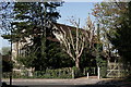
South Croydon
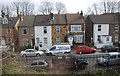
Emmanuel Church, seen from Harewood Road.
Image: © Peter Trimming
Taken: 19 Apr 2020
0.15 miles
9
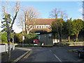
South Croydon, Surrey: Emmanuel Church
Image: © Dr Neil Clifton
Taken: 30 Nov 2011
0.16 miles