
IMAGES TAKEN NEAR TO
Beech Copse, SOUTH CROYDON, CR2 7ES
Introduction
This page details the photographs taken nearby to Beech Copse, CR2 7ES by members of the Geograph project.
The Geograph project started in 2005 with the aim of publishing, organising and preserving representative images for every square kilometre of Great Britain, Ireland and the Isle of Man.

There are currently over 7.5m images from over14,400 individuals and you can help contribute to the project by visiting https://www.geograph.org.uk
Image Map
Images are licensed for reuse under creativecommons.org/licenses/by-sa/2.0
Notes
- Clicking on the map will re-center to the selected point.
- The higher the marker number, the further away the image location is from the centre of the postcode.
Image Listing (61 Images Found)
Images are licensed for reuse under creativecommons.org/licenses/by-sa/2.0
Image
Details
Distance
1

South Croydon
The overgrown trackbed of the former Woodside and South Croydon Joint Railway (opened 1885, closed 1983).
Image: © Peter Trimming
Taken: 9 Mar 2021
0.02 miles
2
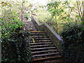
Footbridge into the trees, South Croydon
This footbridge is on a footpath leading from Birdhurst Rise towards Spencer Road. It passes over a disused railway line (the Woodside and South Croydon Joint Railway). This railway closed in 1983. This section of the line is being over run by young tree saplings.
See http://en.wikipedia.org/wiki/Woodside_and_South_Croydon_Railway for more details about the disused railway.
Image: © David Anstiss
Taken: 23 Oct 2011
0.02 miles
3
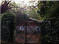
Croydon Scout Hut, South Croydon
Small hut beside a footpath between Birdhurst Rise to Spencer Road.
Image: © David Anstiss
Taken: 23 Oct 2011
0.03 miles
4
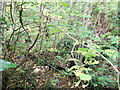
Disused Railway near South Croydon
As seen from a footpath from Spencer Road to Birdhurst Rise.
It passes over a disused railway line (the Woodside and South Croydon Joint Railway). This railway closed in 1983. This section of the line is being over run by young tree saplings. The railway sleepers and the tracks can still just be seen through the trees. (Plus a dumped TV set! )
See Link for more details about the disused railway
Image: © David Anstiss
Taken: 23 Oct 2011
0.03 miles
5
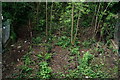
South Croydon
The overgrown trackbed of the former Woodside and South Croydon Joint Railway (opened 1885, closed 1983).
Image: © Peter Trimming
Taken: 29 Apr 2020
0.04 miles
6
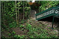
South Croydon
The overgrown trackbed of the former Woodside and South Croydon Joint Railway (opened 1885, closed 1983).
Image: © Peter Trimming
Taken: 29 Apr 2020
0.04 miles
7
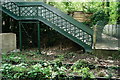
South Croydon
The overgrown trackbed of the former Woodside and South Croydon Joint Railway (opened 1885, closed 1983).
Image: © Peter Trimming
Taken: 29 Apr 2020
0.05 miles
8
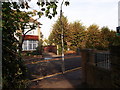
Footpath crosses Birdhurst Rise
A path leads from Croham Road through a part of suburban South Croydon towards Hurst Road near South Croydon Railway Station.
Image: © David Anstiss
Taken: 23 Oct 2011
0.05 miles
9
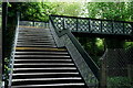
South Croydon
Footbridge across the overgrown trackbed of the former Woodside and South Croydon Joint Railway (opened 1885, closed 1983).
Image: © Peter Trimming
Taken: 29 Apr 2020
0.05 miles
10
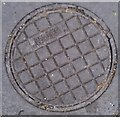
Thames Water meter cover
Totally boring image of the standard (plastic) water meter access cover as installed by Thames Water. Uploaded to compare and contrast with Image the splendid way they do it in Ireland.
To make this page a bit more interesting here are some factoids from https://en.wikipedia.org/wiki/User:Payalcom/sandbox on Wikipedia:
Q. Why are man hole covers round?
A1. A circle is easier to manufacture.
A2. Cannot have situations, like with a square lid, where the lid falls into the hole because the edge is smaller than the diagonal.
A3. Can be locked in place by doing a quarter turn.
(The system does not seem to support a view direction of looking vertically down!)
Image: © Roger W Haworth
Taken: 9 Jul 2014
0.06 miles